Historic BIM: From 3D Laser Scanning to Revit Model
Introduction
Preserving our rich architectural heritage is a crucial endeavour that requires a delicate balance between conservation and adaptation. In the realm of building information modelling (BIM), laser scanning technology and Revit software have revolutionised the way historic buildings are documented and analysed. This blog explores the fascinating world of Historic BIM, with a particular focus on the integration of laser scanning and the creation of accurate measured building surveys in Revit. Join us on a journey that unveils the power of technology in safeguarding our architectural legacy.
The Importance of Measured Building Surveys
Before delving into the realm of laser scanning and Revit, it is essential to understand the significance of measured building surveys. These surveys serve as the foundation for capturing precise geometric data of existing structures. Historic buildings, with their intricate details and unique features, require meticulous documentation to aid preservation efforts, renovations, and adaptive reuse projects. Measured building surveys provide a comprehensive understanding of the building's layout, dimensions, and intricate architectural elements. They serve as a valuable reference for architects, engineers, and conservation specialists, ensuring accurate restoration and maintenance
Laser Scanning: Unleashing the Power of Accuracy
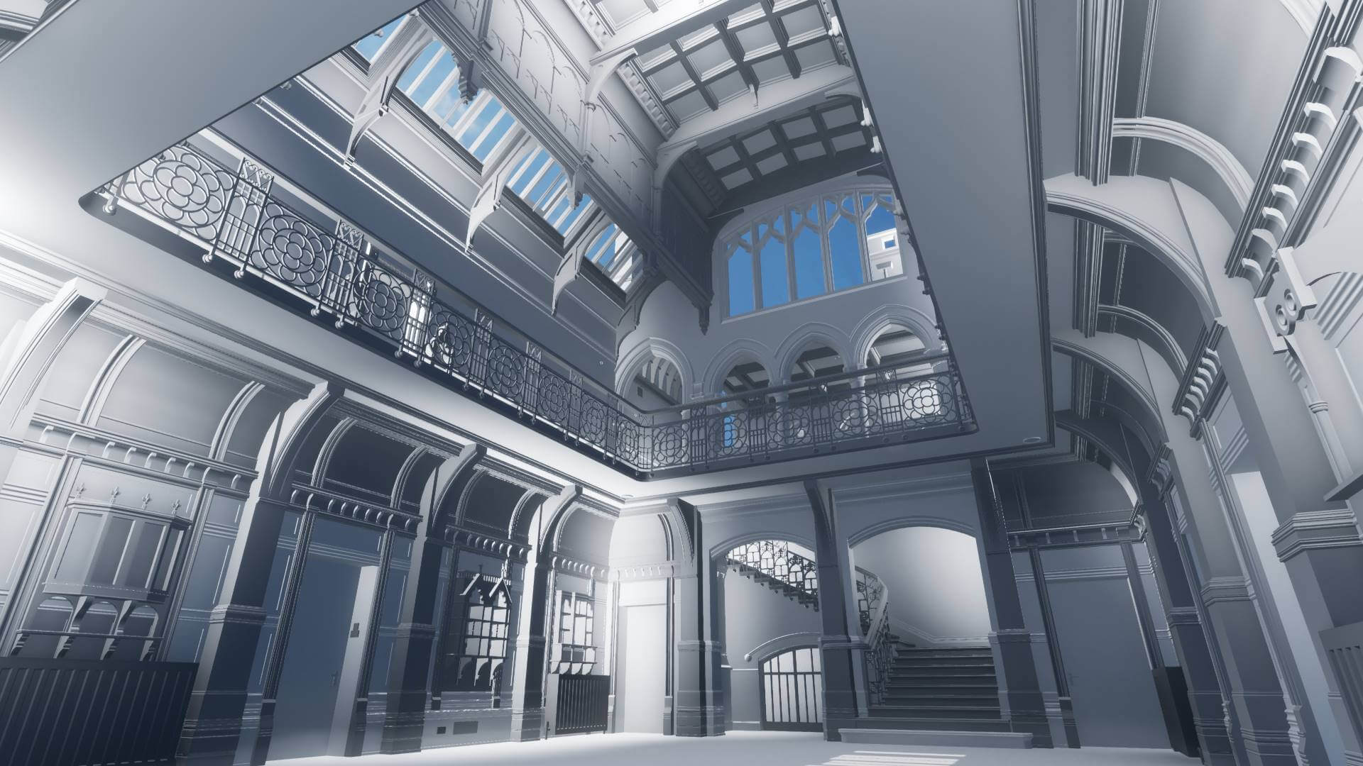
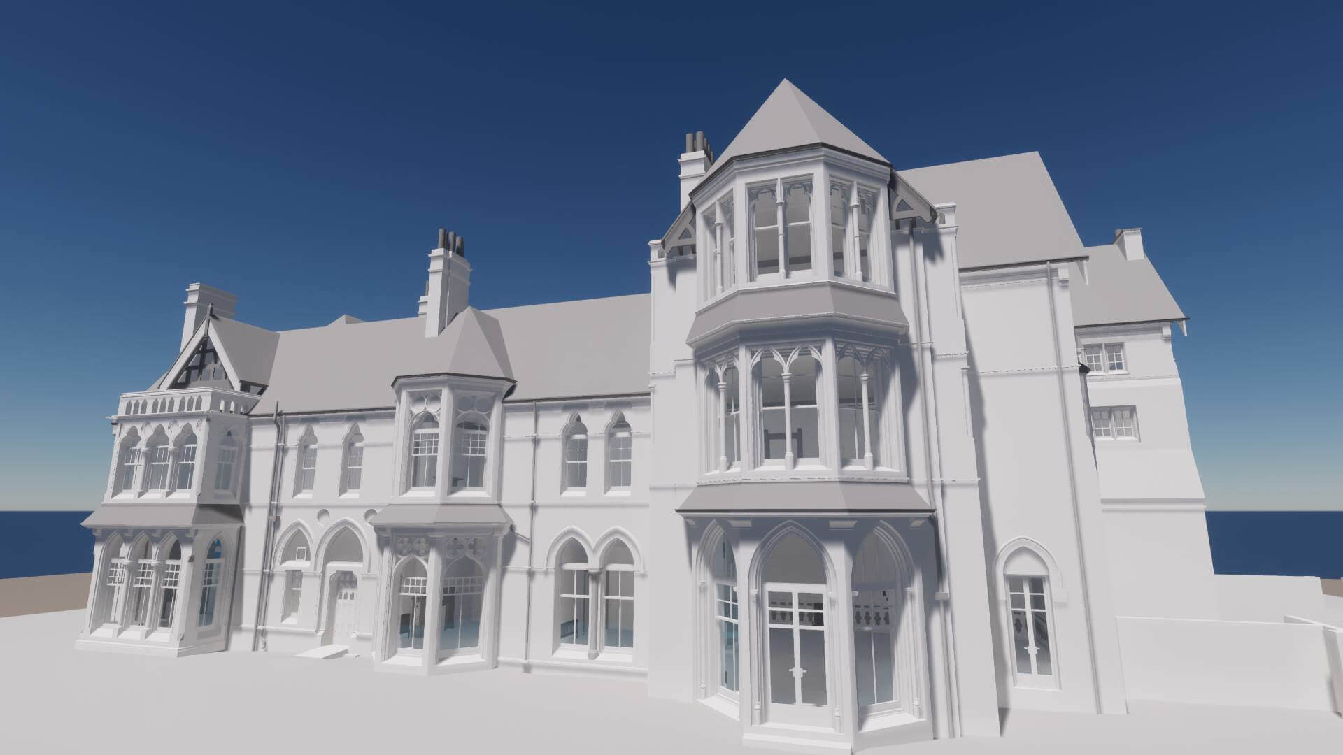
Laser scanning has emerged as a game-changer in the field of heritage documentation. It employs high-precision laser scanners to capture millions of data points, creating a detailed three-dimensional representation of the building and its surroundings. This technology enables the rapid and non-invasive capture of complex geometries, intricate details, and hard-to-reach areas of historic structures.
Laser scanning eliminates the need for manual measurements, providing a comprehensive dataset that serves as a digital replica of the building. This data can be revisited and reanalysed in the future, facilitating further research, analysis, and preservation efforts. The accuracy and level of detail captured by laser scanning enable architects, historians, and conservationists to examine and study the building in granular detail, aiding the decision-making process for restoration and adaptive reuse projects.
Creating Measured Building Surveys in Revit
Revit is a leading BIM software and plays a pivotal role in integrating laser scanning data into measured building surveys. By importing the laser scan point cloud into Revit, professionals can create a digital representation of the historic building. This digital model becomes a collaborative platform for architects, engineers, and heritage specialists to work together seamlessly.
Need help you with your next Historic BIM project?
We've been providing the UK's architects and building conservationists with Historic BIM measured building surveys for more than 15 years and our expertise was called upon by Historic England to help produce their BIM for Heritage Guide.


Steve Bury is the Managing Director of Bury Associates, a land and measured building survey company based in the UK. With over 40 years of experience in surveying, Steve Bury established Bury Associates in 1997 to combine the provision of high quality digital surveys with exceptional customer service. Steve has also designed software applications for measuring buildings to automatically create survey drawings.