
"The project required extremely quick data collection on-site, both for the condition and metric surveys. The site was dangerous and the data collection technique of using drones and ContextCapture proposed by Bury Associates was deemed safer and quicker than using traditional methods. It produced accurate 3D models that allowed some of the condition appraisals to be carried out safely off-site and provided accurate metric data for the cost study. The site was physically challenging. The Bury Associates team showed exemplary attention to detail and colleague care to ensure that safe working procedures were applied, and quickly processed the 3D model that has proved so useful”
Lynda Jubb
Jubb Clews
"We’ve recently used Bury (not my first experience of the company) for a laser survey and Revit model output; first rate communication, responses and modelling, all within my allotted timescales. Perfect service, massive thanks to Steve and his team. We’ll be back…"
Corporate Architecture
“I have worked with Bury Associates on a number of projects. They have always been a pleasure to deal with, are always helpful and are prompt in turning around information.”
Frankie Levey
Rigby & Rigby
"Bury Associates have carried out multiple measured surveys, issuing 2D drawings, 3D models and providing point cloud data which has been all essential as Marylebone Cricket Club considers the future development and ongoing enhancement of Lord's Cricket Ground. Surveys have always been carried out in good time and the information issued swiftly following the completion of each survey."
Jay Neil, Associate Director
Gardiner & Theobald
"Bury Associates have carried out a number of surveys for Peel recently and I have found them to be very responsive, provide an excellent professional service and are good value for money. They are flexible and able to provide surveys in a number of different formats to suit each project and I would not hesitate to use them in the future"
Roger Wheeldon, Director of Development
Peel Holdings

High Detail Measured Surveys Specified to Your Needs
When you’re planning alterations, extensions, or refurbishments, you need a reliable starting point. Our measured building surveys give you an accurate digital record of your property, capturing every dimension and detail.
With a laser scanned measured building survey from Bury Associates, you’ll:
-
Start your project with confidence - your plans are built on precise, verified measurements.
-
Work collaboratively - architects, engineers, and consultants can design from the same digital model.
-
Avoid costly surprises - reduce the risk of errors, rework, and project delays.
-
See every detail - from structural layouts to the smallest architectural features.
Let us capture the detail - so you can focus on the design.
High-Quality Topographical Surveys
Our topographical surveys give you a complete, accurate picture of your site, so you can plan and design with confidence. We record every visible feature and level to your exact specification.
To give you the best possible understanding of your site, we can also include:
-
Positions of surrounding buildings and boundaries
-
Drainage details
-
Underground services survey
-
CCTV drainage inspections
With this level of detail, you’ll have all the information you need to make informed decisions and avoid costly surprises during design and construction.


3D Virtual walk-through Matterport Tours
There is no better way to upgrade your measured building survey than adding a Matterport Tour. A Matterport Tour gives you a 3D virtual walkthrough of your building, allowing you and your design team to explore every room as if you were there in person.
By combining your measured building survey with a Matterport Tour, you can:
-
View and navigate your building online from anywhere
-
Reduce the need for repeat site visits
-
Share the space easily with clients and colleagues
-
Experience complete immersion in your project before work begins
To learn more, read our dedicated blog post on Why you should combine your measured building survey with a Matterport tour.
A Sample Matterport 3D Photographic Tour of the Wimbledon Museum, London
Project Spotlight
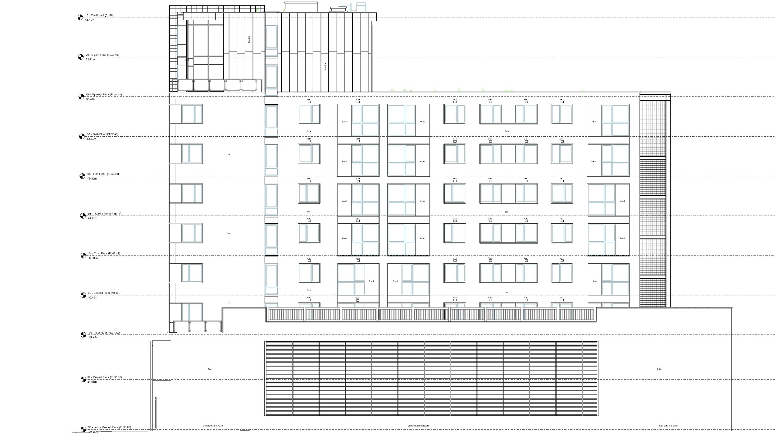
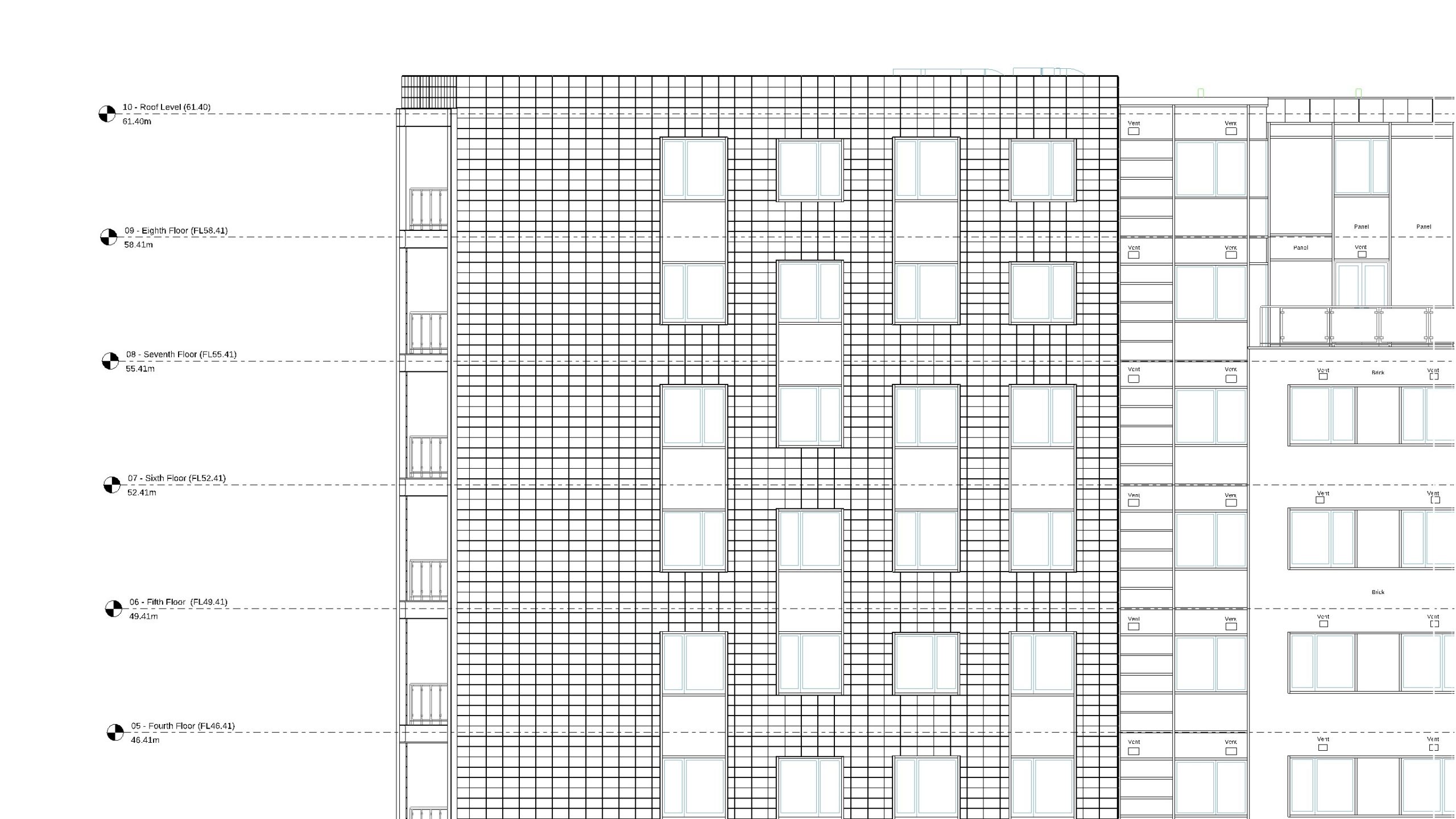
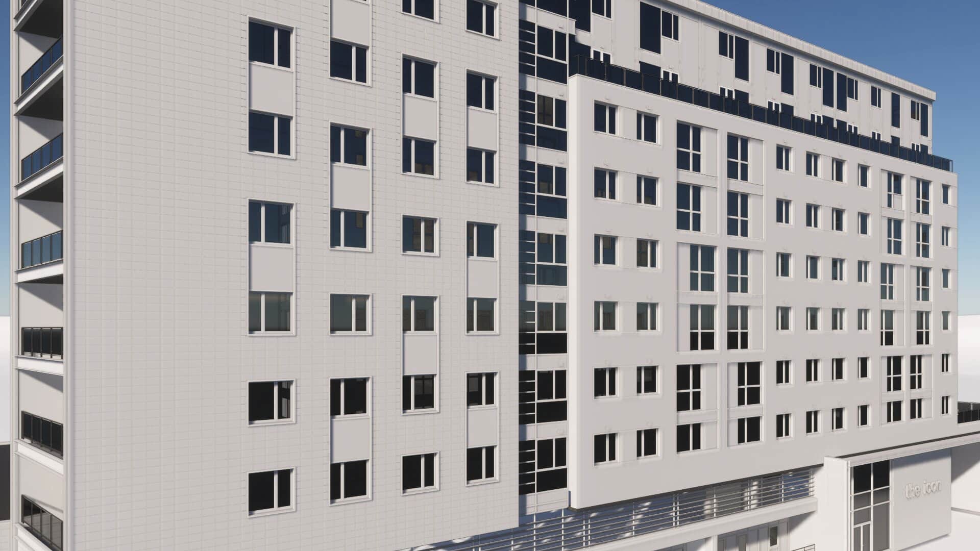
We recently performed a measured building survey of a residential tower block. Our client needed accurate data on the property's internal and external elevations in order to carry out a re-cladding project.
Alongside 2D CAD drawings, we provided a 3D model in Revit, delivering detailed insights which enabled our client to proceed in confidence.
What our clients say
Our Full Range of Services
Matterport Tours
Providing you with a 3D walkthrough tour of your site
Topographical Surveys
Highly detailed land surveys showing all features, levels, and contours
Drone Inspections
Providing you with aerial inspections & surveys for inaccessible areas
Underground Utilities
Using radio detection equipment & GPR to scan underground services
Setting Out
Setting out boundaries, structures, & steelwork, & monitoring movement.
Reality Capture
Photo-Realistic 3D model showing every detail for heritage projects
Experts in bim
We contributed to Historic England's 'BIM for Heritage: Developing a Historic Building Information Model', drawing on our years of experience providing heritage surveys for architectural conservation projects.
