Transform Your Barn Conversion Projects with Our Enhanced Measured Building Surveys
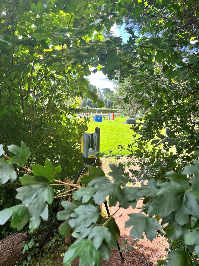
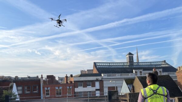
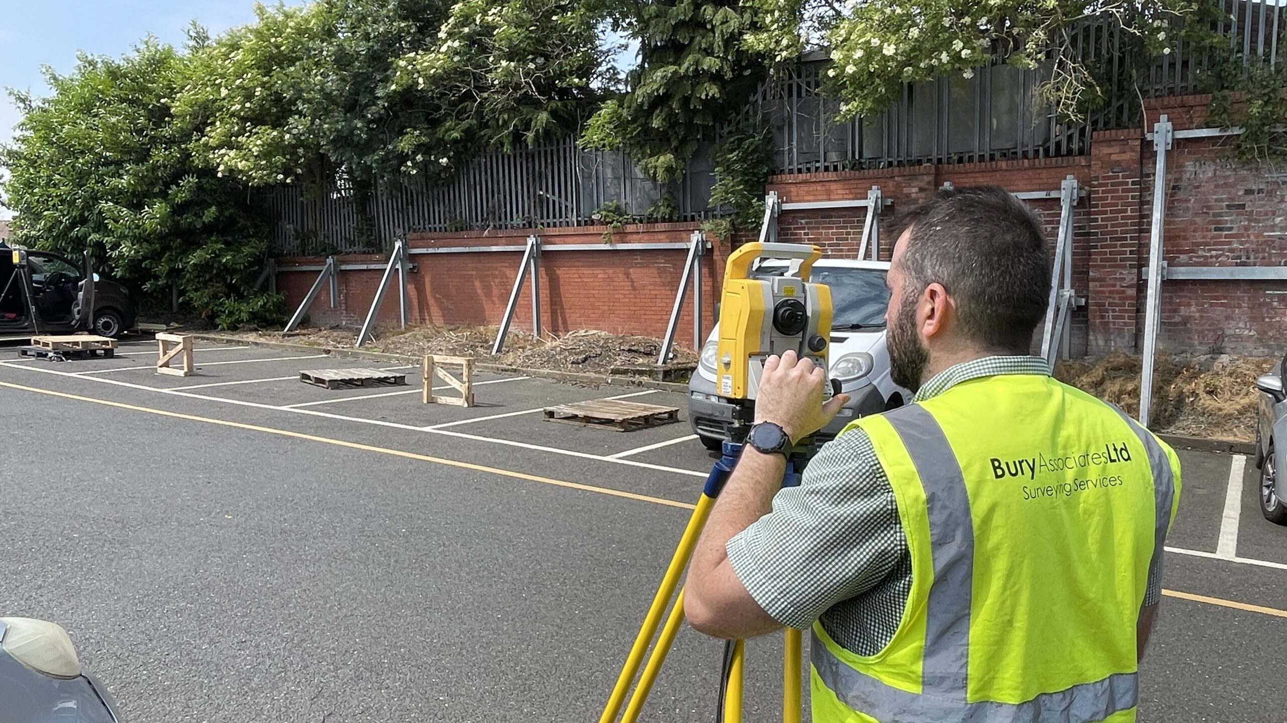
- We use laser scanners, drone photography and Matterport 3D cameras to capture every detail of your barn's structure.
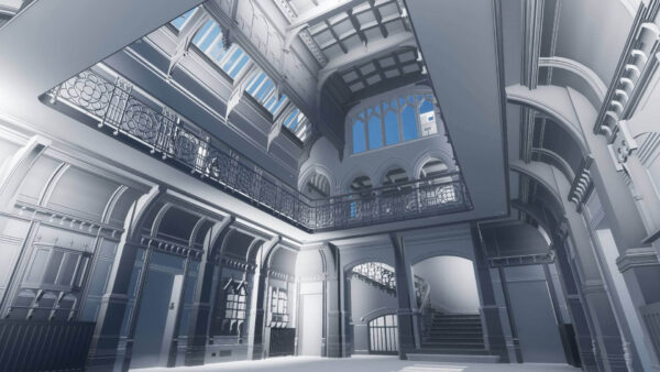
- We give you a photo-realistic 3D model that can be used to fully inspect the outside of the barn.
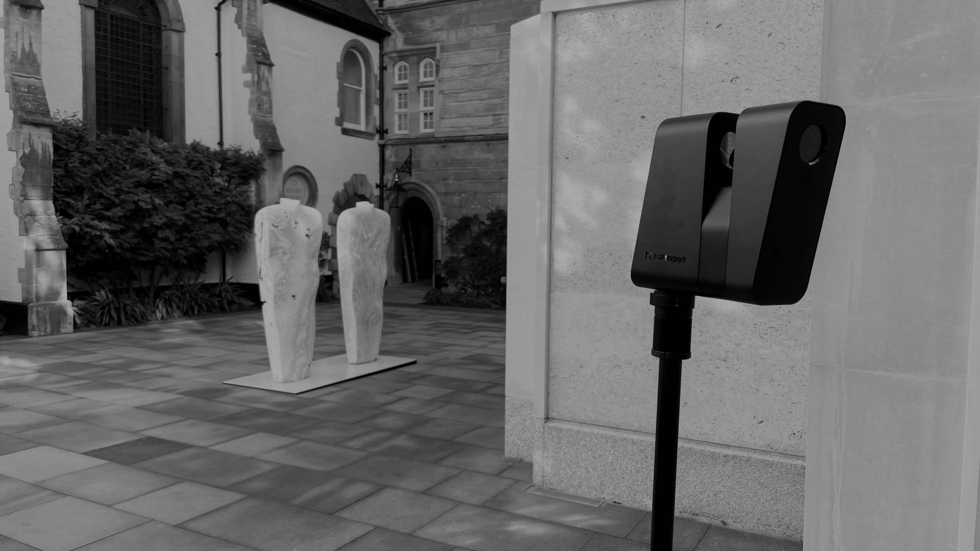
- A Matterport tour is provided so you can inspect the inside of the building.
- We create high-quality CAD drawings showing every detail you need - including joints, cracks, and stonework details.
- 3D Revit or IFC models if required.
- All delivered through a simple online portal so you always have access wherever you are.
Navigating the design and planning stages of converting a barn or listed building is a complex task, especially when dealing with National Parks or an Area of Outstanding Natural Beauty. Bury Associates provide comprehensive, high-detail measured building surveys designed to make this process seamless for you. We produce dimensionally accurate CAD drawings and, if needed, 3D BIM models to provide professionals with the essential data they require.
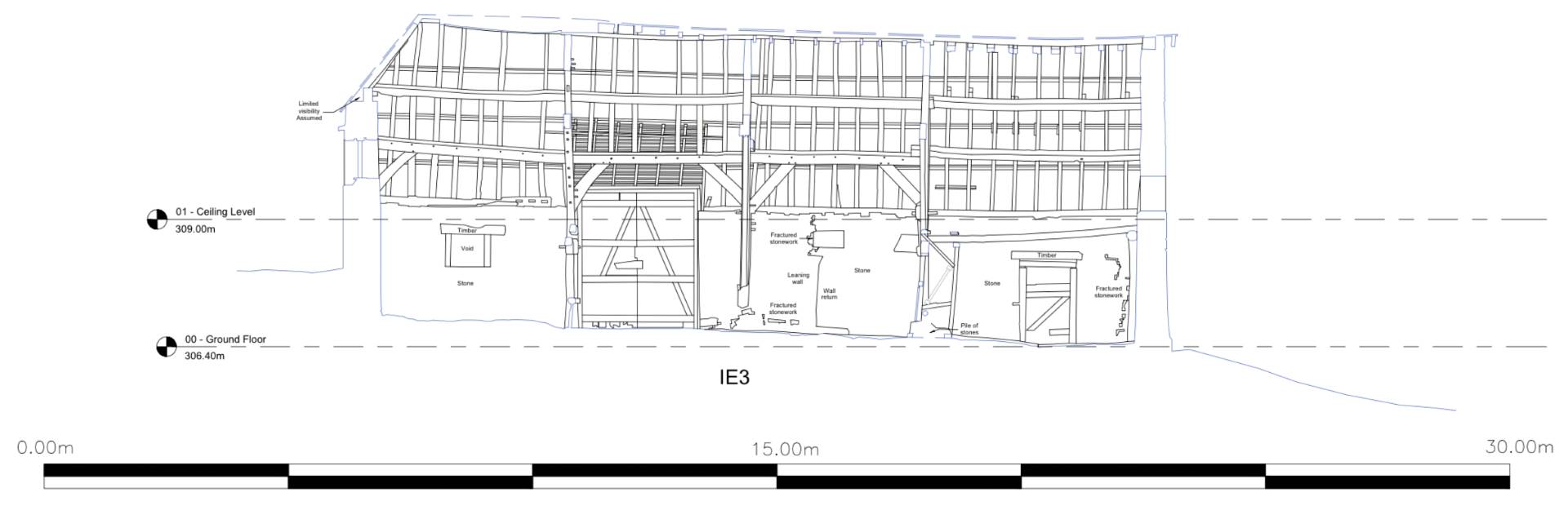
Because we use both laser scanning and drone photogrammetry to create a full 3D capture of the building we produce very high detail internal elevations and elevational sections that fully represent the structure. We can just slice through this 3D data at any time in the future and provide you with any additional sections, plans or elevations you might need later in the project, without needing a return visit to site.
Alongside these technical assets, we create a photo-realistic 3D model of the building's exterior and an interactive Matterport tour covering both the inside and outside. These visual tools provide you with invaluable insights, and can also be easily used by those who may not have the opportunity to visit the site or are not well-versed in technical drawings or 3D models.
To enhance accessibility, we host all these resources on our user-friendly online portal. This approach not only reduces the necessity for multiple site visits but also ensures that everyone involved in the project has a comprehensive understanding of the building's structure. In this way, we streamline the entire conversion process for all stakeholders.
Case Study: 15th Century Barn in Brecon Beacons National Park
Our client faced a challenging design project: repurposing a Grade II listed, 15th-century stone barn located in the Brecon Beacons National Park.
What We Delivered:
- 3D Laser Scanning: Captured the entire structure to create a precise 3D model.
- High-Resolution Photography: Utilised drones and DSLR cameras for a complete condition assessment.
- Immersive Matterport Tour: Allowed stakeholders to explore the barn virtually and add annotations.
- Detailed 2D CAD Drawings: Showed every joint and crack, crucial for fully understanding the ancient structure.
- Integrated Online Portal: All documentation and models were accessible in one place, simplifying collaboration.
Contact Us Now About Your Project
You’ll Also Need Some Of These …
The Outcome
Our client was exceptionally pleased with the quality of our work, noting that our survey significantly reduced the need for additional site visits and inspections.


FAQs
About Us
Bury Associates was established in 1997 by Steve Bury. His aim was to provide a top-quality service to clients needing topographical and measured building surveys throughout the UK.
The company has grown steadily over the years and now includes surveyors, drone pilots, CAD operators, dedicated BIM specialists and administrative staff.
"We pride ourselves on being an innovative company. We always use the latest and best survey equipment available and provide excellent customer service" Steve Bury, MD
Bury Associates use the latest drones, robotic survey instruments and laser scanners. This allows even large sites to be surveyed extremely quickly and accurately. Surveys are enhanced by using network GPS to place projects onto precise Ordnance Survey co-ordinates and datum.
Customer Feedback
“We have been really happy with the delivery of the Revit models provided by Bury Associates. The models have been instrumental in obtaining the information we need and we look forward to working with Bury again in the future”
"A beautiful job, thank you very much"
"The drawings are excellent"
"Having a survey of both our main venues on Webshare has enabled visiting companies to carry out site visits (including accurate dimensioning) remotely. At the same time, the Webshare alleviates headaches for Malvern Theatres by assisting tours who are unaware of any constraints. A picture tells a thousand words (especially when it is mm accurate!) Webshare saves money for the visiting tours and hassle for the venue at a reasonable cost".
"We have commissioned Bury Associates for a number of projects. Their performance and support is always at the top level in the industry. Often our projects involve work around sensitive or complex environments and we are very pleased with the professionalism Bury demonstrate in their work. While we usually only obtain 2D survey data, the Webshare facility they offer is a hugely useful resource in revisiting elements of the site during the course of a project"