3D Laser Scanning Surveyors

Providing High Detail, High Accurate 3D Scanning For Your Projects

CAD Measured Building Survey

Our advanced laser scanning surveys capture every detail in 3D, ensuring high-precision data collection so you always have all the information you need to complete your project successfully. We are experts in precise 3D data capture for a wide range of purposes in any environment. Our 3D laser scanners can emit up to a million laser beams per second, covering a full 360-degree scan of your site in a remarkably short time. This makes laser scanning an ideal solution for complex, inaccessible, or even hazardous sites.

Our 3D Laser Scanning Services

CAD or BIM Outputs | Measured Building Surveys | Historic Conservation | Construction Verification | Industrial Measurement | Civil Engineering | Plant, Equipment & MEP | Topographical Surveys

Compatibility with Advanced 3D Modelling Programs

We provide point cloud data that's pre-formatted and accurately registered onto your site's coordinate system, making it effortless to import into 3D models created in  software such as Revit, AutoCAD, Vectorworks, ArchiCAD, and Microstation.

Laser Scanned Measured Building Surveys

Laser scanner surveying The Scala, Worcester

Laser scan surveys are essential for producing a high-detailed and accurate measured building survey. Our 3D surveys offer detailed and accurate representations of buildings, facilitating precise planning and documentation. 3D BIM deliverables such as Revit or IFC are efficiently created from the laser scan data by our in-house modelling team. We have been providing measured surveys as Revit model since 2007, giving us a wealth of unparalleled experience.
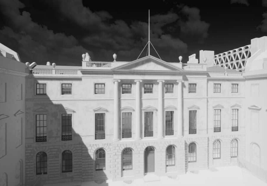
Historic Conservation and Laser Scanning Survey

In historic conservation, laser scanning is invaluable. It allows for the non-intrusive documentation of heritage sites, preserving their integrity while providing detailed data for restoration and preservation efforts. Heritage projects are often extremely complicated structures where the only way of truly understanding them is through a 3D model.
Topographical Survey - Full 3D Capture

Paired with GNSS receivers and Total Stations, laser scanners allow fast and safe data collection, even in potentially dangerous environments such as along highways to produce data-rich topographical surveys. Our advanced survey software extracts topographic detail from the laser scans for fast delivery.

Accurate 3D Laser Scanning for Civil Engineering

All Civil engineering projects can benefit from the accuracy and detail provided by 3D laser scanning. In civil engineering, laser scanning offers insights into terrain, structures, and construction sites, enabling precise planning and effective management of large-scale projects. The volumes of stockpiles and materials can be quickly calculated, progress monitored and the flatness of floors assessed.

Laser Surveys: Versatile and Comprehensive

Our 3D laser scanning survey is highly adaptable and well-suited for a variety of environments including heritage and historic buildings, where facade surveying is crucial.

Ensuring Accurate Construction Verification with Laser Scanning

In construction verification, our laser scanning surveys play a critical role. Scanned point clouds are compared with the 3D BIM design model to check everything has been built correctly and within the specified tolerances. This process identifies discrepancies early and avoids the need for costly corrections.

Industrial Measurement: The Precision of Laser Scanning

Industrial measurement demands exactness and is key to ensuring operational efficiency and safety.. Our laser scanning services offer detailed insights into complex industrial environments, aiding in maintenance, redesign, and expansion projects via a 3D point cloud.

Laser Scanning for Plant, Machinery & MEP

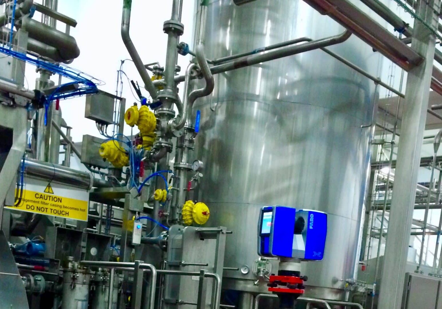
Laser scanning industrial plant for 3D modelling in Revit

For plant, machinery and Mechanical, Electrical, and Plumbing (MEP) systems, laser scanning ensures the precise measurement and mapping out of complex arrays of equipment, pipes, cables and ducts. Our in-house modelling team will turn the scans of any system into a detailed 3D BIM or CAD model - essential for making changes to the existing system or for the installation, maintenance, and retrofitting of complex systems.

Point Cloud Data: The Foundation of Precision

Point clouds are a collection of data points in a three-dimensional coordinate system, created using 3D laser scanning technology. Each point in the cloud corresponds to a specific location in space, representing a tiny portion of the surface of the object or area being scanned. This technology is crucial for accurately capturing the physical dimensions and shape of an environment or object.

In a laser scanning process, a laser scanner emits beams of light that reflect off surfaces and return to the scanner. The time it takes for these beams to return is measured to calculate the distance of each point from the scanner. These measurements are then used to create a dense aggregation of points, forming the point cloud. 

Cloud Point Survey: Rich Detail and Flexibility

Beyond just the spatial coordinates (X, Y, and Z), point clouds can also store color and intensity values for each point. The color information, typically derived from photographs taken alongside the scanning process, adds a layer of visual realism to the models, making them not only accurate in form but also in appearance. The intensity value of each point, a measure of the strength of the returned laser signal, can provide additional information about the surface characteristics of the scanned object or area.

Point clouds are invaluable in numerous fields like architecture, engineering, and construction for their ability to provide detailed and precise representations of buildings, landscapes, and complex structures. They enable professionals to conduct thorough analyses, create accurate 3D models, and efficiently plan, design, and monitor various projects. In the realm of heritage conservation, point clouds offer a non-intrusive means to document and preserve historical sites, capturing every detail in high fidelity while ensuring the physical integrity of these precious structures.

Integration of Laser Scan Data with BIM

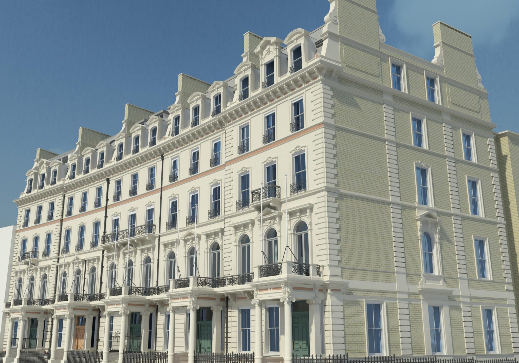
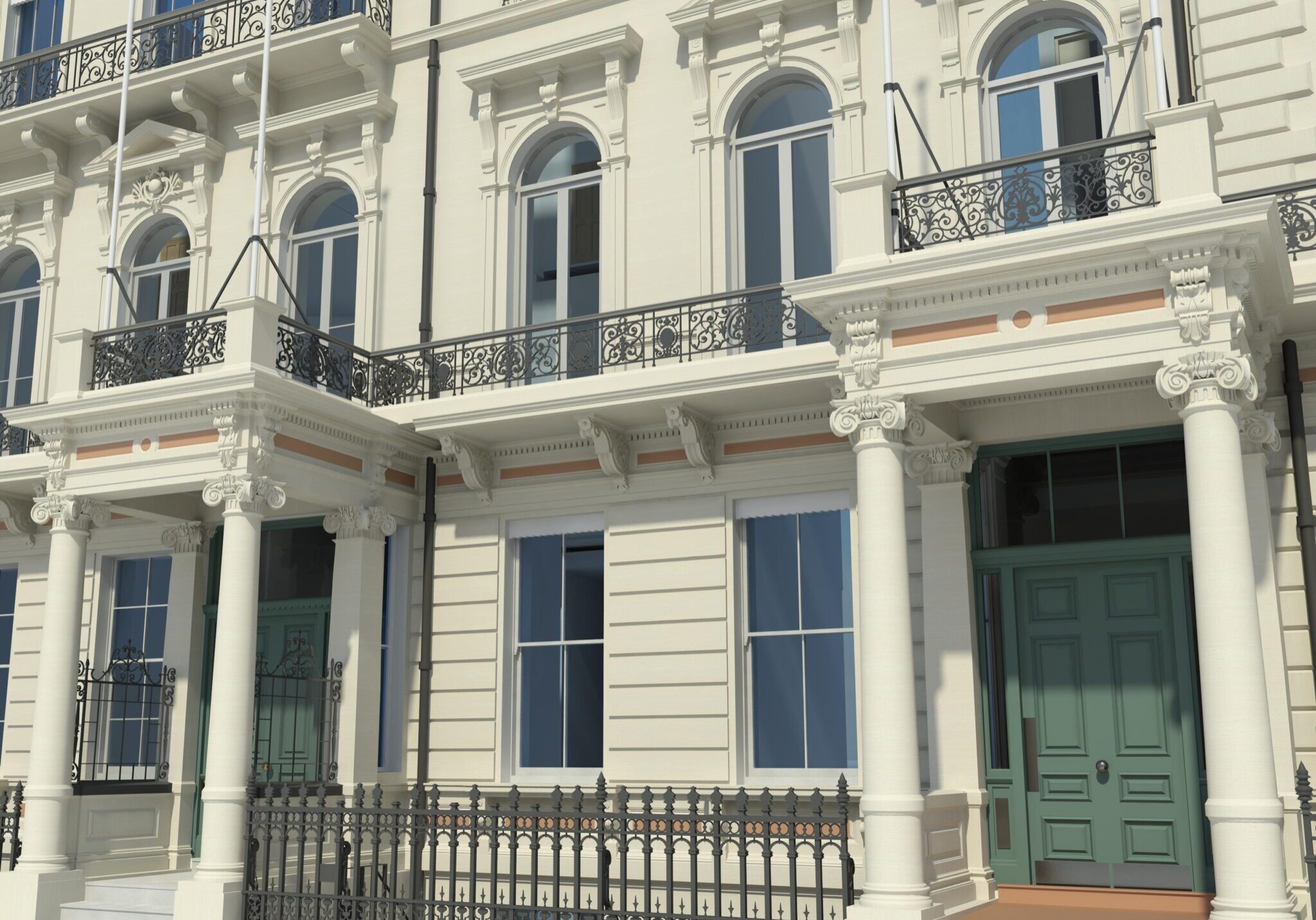
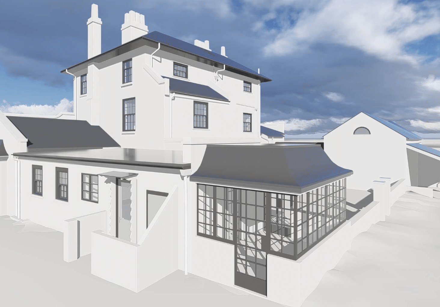
Historic BIM: Revit Model Highbury Hall

The integration of laser scanned point clouds with Building Information Modeling (BIM) represents a significant advancement in the architecture, engineering, and construction (AEC) industries. Point clouds, derived from laser scanning, capture the as-is condition of a building or structure in minute detail. When integrated with BIM software such as Autodesk Revit, Archicad, Vectorworks, Bricscad BIM, Tekla or Bentley Microstation, these point clouds become a powerful tool for creating precise as-built models. This process is often called Scan To BIM or SCAN2BIM.

In Revit, the process begins by importing the point cloud data, which serves as an accurate, real-world reference for the entire BIM process. This integration allows architects and engineers to overlay or 'trace' new designs over the scanned data, ensuring that their BIM models align perfectly with the actual physical dimensions and conditions of the site. This capability is particularly valuable in renovation and retrofit projects where accuracy in understanding existing conditions is crucial.

In the realm of construction verification within the BIM environment, point clouds are indispensable. They provide a means to compare the as-built condition (captured by the laser scan) against the as-designed model in the BIM software. This comparison helps in identifying discrepancies between the planned design and the actual construction, enabling timely corrections and adjustments.

For us at Bury Associates, our approach involves our in-house modelling team using these laser scanned point clouds in Revit to develop detailed as-built models. This process ensures that our models accurately reflect the current state of a building or structure, providing an essential foundation for any further design, construction, or renovation work. By combining the precision of laser scanning with the versatility of BIM, we deliver models that are not only accurate but also immensely useful for all stakeholders involved in the construction process.

Laser Scanning Surveys: A Comprehensive Overview

What is a laser scanning survey?

Laser scanning surveying involves the use of laser scanners to capture detailed 3D representations of physical environments, crucial for various engineering and construction applications.

  • Swift, effective data capture compared to traditional methods.
  • Comprehensive survey solutions including point clouds and Revit models for BIM.
  • Suited for a myriad of project sectors, including historic and heritage schemes.
  • Optimal for sites with hazardous or limited access.
  • Subsurface laser scan surveys can map out inaccessible voids.
  • Easily exportable data for CAD software or other rendering systems.
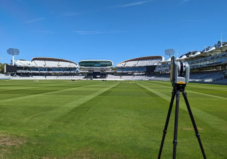
Scanner set up to survey a heritage site

How do I get a 3D laser survey?

Our team of laser scanning surveyors brings years of experience across a broad spectrum of surveying services. We’re ideally placed to discuss your specific needs and recommend the best approach for your project. Get in touch today using the enquiry form below.

  • Contact us now and receive a fixed price quotation
  • Email us to accept our proposal as soon as possible to avoid any delays
  • We’ll arrange dates with you to carry out and deliver your building surveys
  • Your survey will be processed by our skilled in-house team

Testimonials

What our customers say

Adam Jones
31/08/2022
From initial enquiry to project delivery, the team have been beyond helpful. Great communication and delivered what they promised they would. We will be recommending them and using them again should we need any further works carried out. Thank you!
Luis Trevino
26/05/2022
I've been commissioning Bury Associates survey drawings for over 10 years, that says plenty! I fully recommend them!
Corporate Architecture
02/03/2022
We've recently used Bury (not my first experience of the company) for a laser survey and Revit model output; first rate communication, responses and modelling, all within my alloted timescales. Perctect service, massive thanks to Steve and his team. We'll be back...
Alex Milton
23/09/2021
Extremely quick to get out to do the survey for us and very responsive via email
Frankie Levey
09/08/2021
I have worked with Bury Associates on a number of projects. They have always been a pleasure to deal with, are always helpful and are prompt in turning around information.
Richard Nicol
03/08/2021
Bury Associates have been a pleasure to deal with. Excellent communication which has always been prompt and helpful. Recommended.
Amara Roca Iglesias
24/06/2021
We work with Bury for the first time and are extremely happy with the level of information they provided and very impressed with their attitude. They are super kind, responsive and professional! It's been a pleasure to work with them and we would definitely be commissioning them again in future.
Richard Savory
13/04/2021
We've had brilliant service from Bury Associates - very prompt and professional. All RFIs are dealt with immediately. Fantastic.
Myles Reece
03/03/2021
This was the first time I have worked with Bury Associates and I was extremely impressed with the service and quality of the information they produced. I would happily recommend them them and will be using their services again.
James Verner
24/11/2020
So helpful with my research