Topographical Survey for a Landslip
At Bury Associates, we find that our clients have many reasons for needing a topographical survey. These can vary from requiring boundaries for land registry applications, to expanding the facilities of a seal sanctuary. Whatever our clients' needs, Bury Associates are happy to oblige. However, one of the most important, and sometimes forgotten, uses of a topographical survey is for monitoring land displacement.
Need a Topographical Survey?
What is a Landslip?
Also known as a landslide, a landslip is the fall of soil, rocks, and earth down a slope. In the UK, landslips cause significant disruptions when they affect roads, railways, or other infrastructure, rendering them unsafe as well as incurring financial costs. Mitigating the risks posed by landslips is therefore highly important.
Landslips are a fairly common event and occur across the UK. Certain conditions, such as heavy rainfall, can cause an immediate risk. However, changes over time, such as the erosion of the slope's base, can also raise the likelihood of landslip occurrence.
How To Measure Land Slip Movement with a Topo
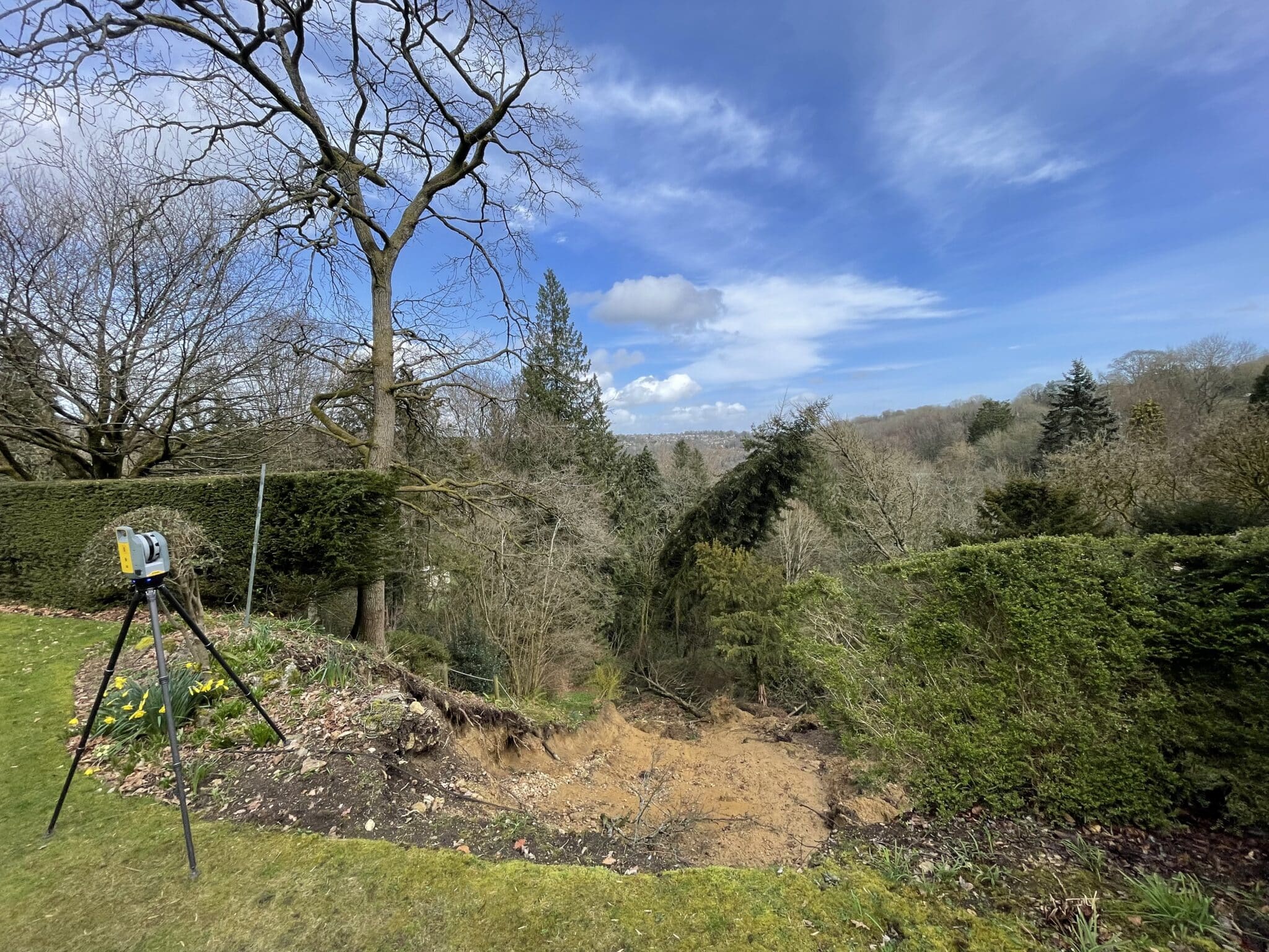
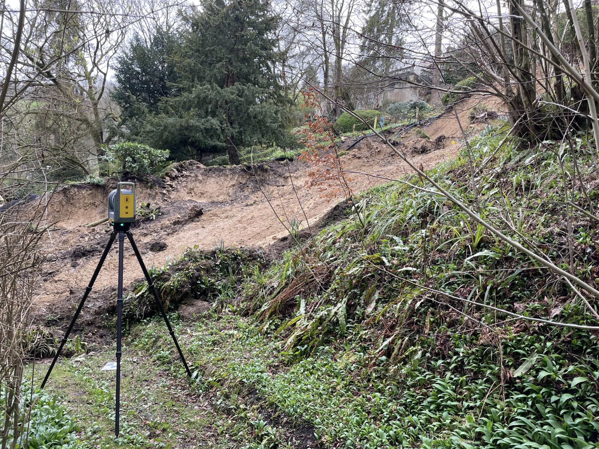
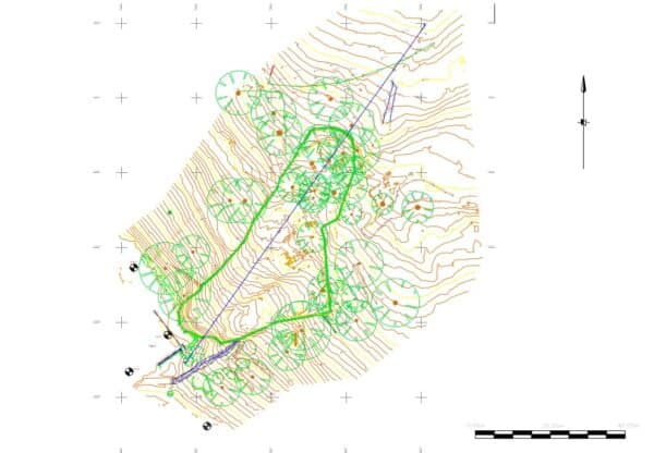
Recently, Bury Associates carried out a survey of a landslip, intended for use by engineers in designing a method of stabilisation. First, we mapped out its extent. Following this, we created a 3D CAD model, 2D drawings, as well as a contour map. This displayed the steepness of the slope and what exactly had moved. Using a GNSS receiver, the data was connected to Ordnance Survey (OS) coordinates, meaning that the survey would sit correctly on their digital mapping system.
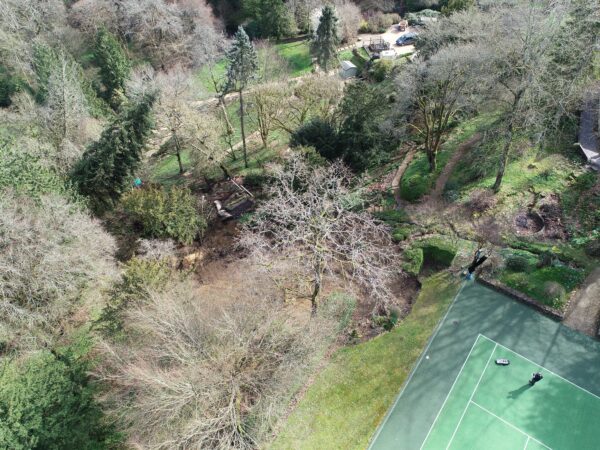
To collect the information, our surveyors used a laser scanner alongside conducting a drone survey. The drone's ability to capture accurate data from an aerial perspective was instrumental in ensuring the safety of our surveyors on what was a dangerous site. Due to rainfall causing further slippage, we had to return several times to ensure the accuracy of the data collected.
Causes of a Landslip
The landslip surveyed by Bury Associates occurred underneath a stream going through a private garden. The stream was crossing a bank that had been altered in the early twentieth century to create a tennis court. It is therefore probable that the land slip occurred due to the moisture resultant from proximity to the stream.
At Bury Associates, we conduct our topographical surveys for all kinds of projects and purposes. Get in touch today for a free quote and we'll handle the rest!


We can provide your topographical survey
Steve Bury is the Managing Director of Bury Associates, a land and measured building survey company based in the UK. With over 40 years of experience in surveying, Steve Bury established Bury Associates in 1997 to combine the provision of high quality digital surveys with exceptional customer service. Steve has also designed software applications for measuring buildings to automatically create survey drawings.