Re-cladding Tower Blocks: Why Elevation Surveys Are Essential
As tower blocks across the country prepare to shed their outdated cladding, I reflect on the importance of elevation surveys to the safety and effectiveness of this initiative.
Introduction
The installation of new cladding first requires an investigation of the building's exterior, known as an elevation survey. Usually included within the scope of a measured building survey, an elevation survey assesses the height, width, and depth of various elements of a building's facade. Using purpose-built survey equipment, primarily laser scanners, total stations, and drones, surveyors take accurate measurements of a number of elements. Crucially for re-cladding, these include:
- The exact size and position of current cladding panels;
- Locations of expansion joints;
- Courses of bricks.
Generally speaking, elevation surveys also provide information about the following features:
- Openings (windows and doors);
- The dimensions of walls;
- Architectural details (cornices, mouldings);
- Any protrusions or irregularities on the building's exterior.
As we might expect, the reason why an elevation survey is crucial to a re-cladding project is due to the focus of the refurbishment on the building's exterior.
Why would a tower block require new cladding?
Over time, tower blocks may need to be re-cladded for reasons such as an update of the building's external facade, or the deterioration of existing panels.
Of course, I cannot neglect to mention the influence of the Grenfell tragedy on the UK's current trajectory of re-cladding. In July 2017, the government published the Building Safety Programme, which labelled Aluminium Composite Material (ACM) cladding systems as unsafe. This demanded urgent action: the replacement of unsafe cladding on the external walls of those high-rise residential buildings measuring at least 18 metres. Since that date, the instruction has been broadened to include the replacement of unsafe non-ACM cladding.
Why is an elevation survey necessary?
When making plans for the refurbishment of a tower block, elevation surveys are critical due to the information they provide on the building's existing features. Developers need a foundational understanding of the building as it stands before they can make arrangements for its transformation. Without this insight, plans can be ill-informed, any structural issues and limitations being identified only once work on the site has already begun. This increases the overall spend both of time and money on the project. Not to mention, plans made without attention to the building's existing state may not be executed to the highest standard, nor can adherence to safety regulations be flawless.
How is an elevation survey performed?
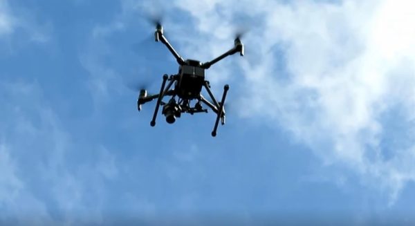
Skilled practitioners use a set of survey equipment, with each instrument specialising in a different method of data collection. Using LiDAR, a drone can measure data on remote elements of the building's facade, as well as take pictures for visual documentation. On the other hand, a total station can record distances between fixed points to accuracies within 0.5 arc-seconds. The process of data collection can be completed within 1-2 visits to the site. In the case of a tower block, with the remoteness of its survey points, laser scanning equipment has revolutionised the data collection process, ensuring surveys are both safe and highly precise.
What does an elevation survey achieve?
A comprehensive elevation survey provides:
- An exact layout of existing facades, displaying the current cladding panels, expansion joints, and brickwork
- Insight into the building's structural integrity, highlighting potential issues that could affect the safety of the re-cladding project
- Detailed architectural documentation, which enables the preservation of important design features, ensuring that new cladding respects the building's character.
- Assurance that the re-cladding project adheres to local building regulations and standards, which is especially crucial for buildings in sensitive or historic areas.
How is an elevation survey delivered?
Typically, results from elevation surveys are delivered in computer-aided design (CAD) format. These digital representations take the forms of either 2D or 3D Revit, depending on the level of detail required for the project. Laser scanning equipment transmits data to a point cloud, with each point representing a specific location in 3D space. Using this depth of insight, technicians can create highly-accurate models of architectural structures like tower blocks. Please see our post on survey equipment and technology for more information on how laser scanners help us to create detailed 3D surveys.
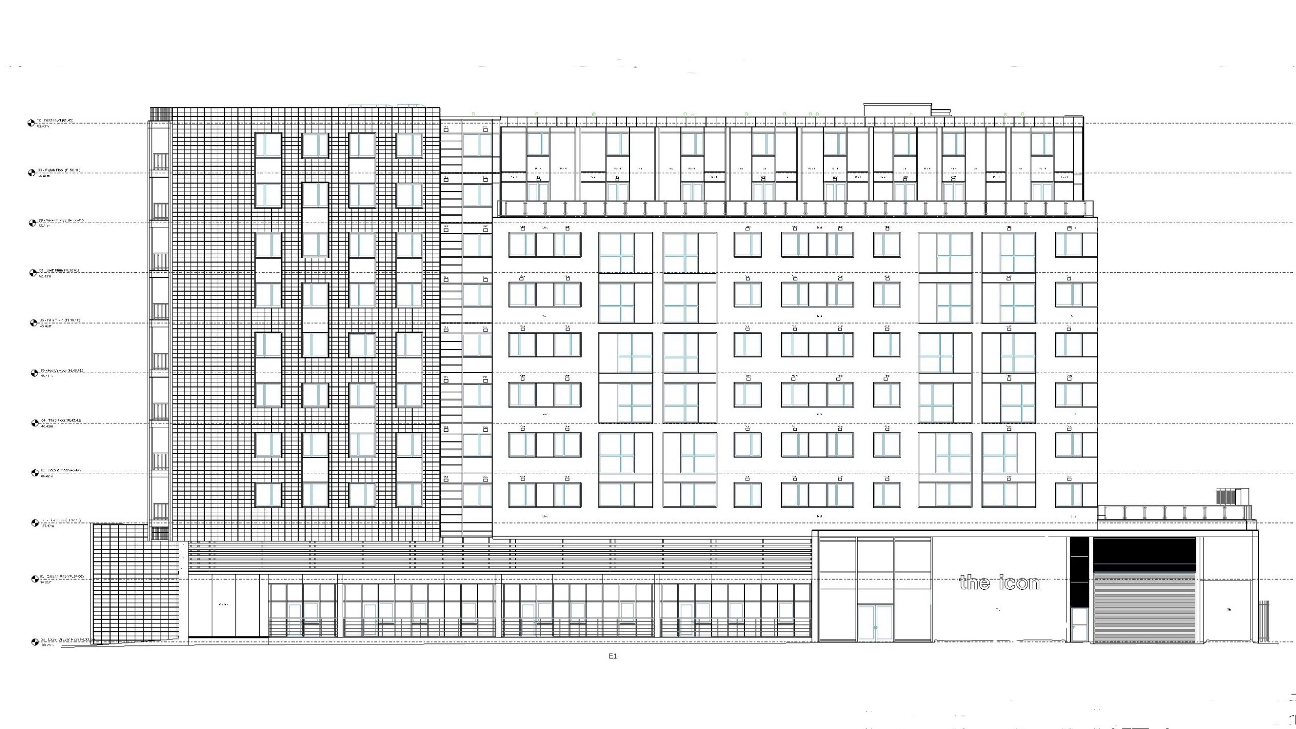
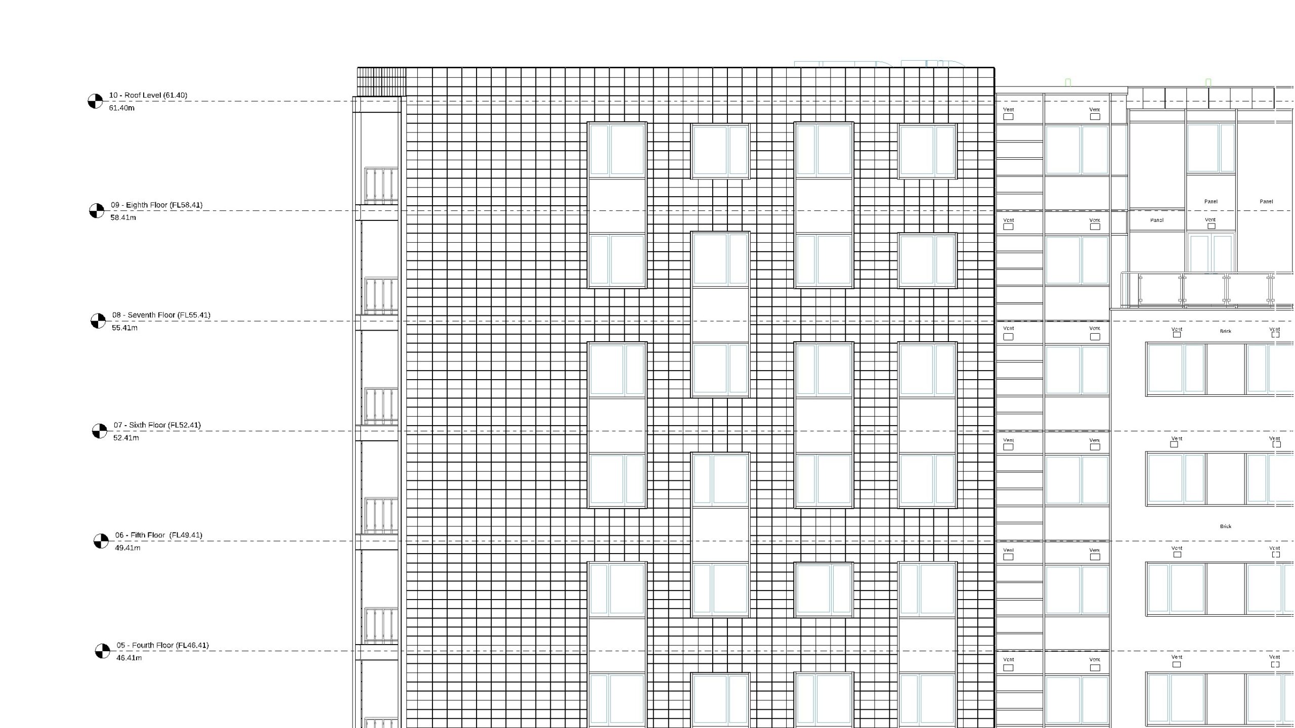
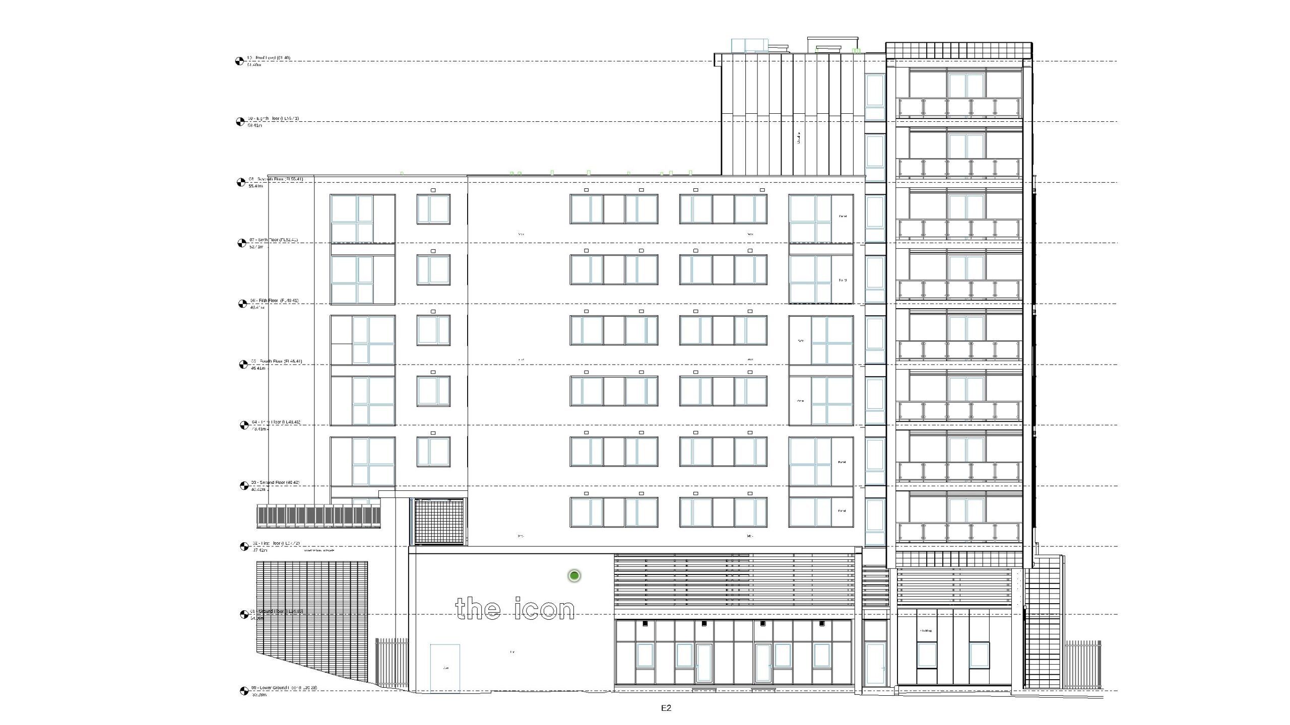
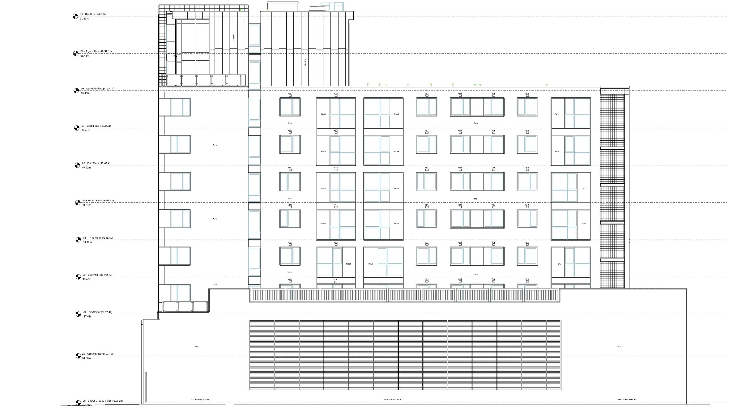
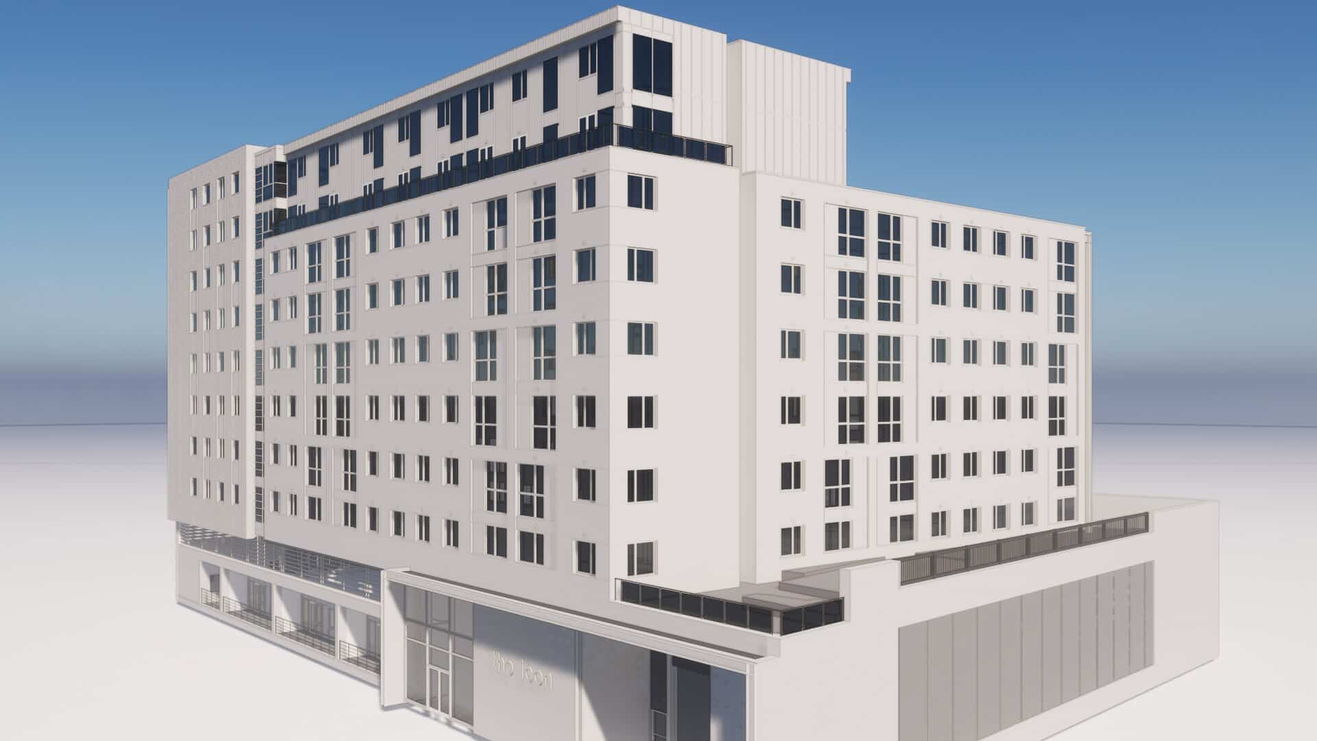
Earlier this year, Bury Associates conducted an elevation survey of The Icon in Basildon, a residential building proposed for re-cladding. Shown below are the 2D CAD drawings that we produced of the structure:
As you can see, our skilled technicians transformed the raw data into easy-to-interpret drawings for the perusal of stakeholders. This gave developers a much clearer idea of how to approach the re-cladding project.
Conclusion
Elevation surveys are integral to the planning stage of re-cladding a tower block. At Bury Associates, we capture every detail of your building's facade in 3D, enabling you to make plans for your re-cladding project in full confidence.
With over 25 years of experience in delivering elevation surveys, we are ready to discuss your project in detail. The solution is simple - contact us today for a free quotation.
Ready to find out more?
Tell us about your project today.
Steve Bury is the Managing Director of Bury Associates, a land and measured building survey company based in the UK. With over 40 years of experience in surveying, Steve Bury established Bury Associates in 1997 to combine the provision of high quality digital surveys with exceptional customer service. Steve has also designed software applications for measuring buildings to automatically create survey drawings.

