
Measured Building Surveys
A measured building survey is a highly detailed digital version of your building. Measured surveys allow professionals across the construction industry to work collaboratively in a unified digital space, where they can lay their own designs atop the true dimensions captured in the survey. Highly experienced measured building surveyors use laser scanning and total station technology to capture even the finest details, which brings assurance to the planning process by minimising the possibility of unforeseen costs and delays.
"The project required extremely quick data collection on-site, both for the condition and metric surveys. The site was dangerous and the data collection technique of using drones and ContextCapture proposed by Bury Associates was deemed safer and quicker than using traditional methods. It produced accurate 3D models that allowed some of the condition appraisals to be carried out safely off-site and provided accurate metric data for the cost study. The site was physically challenging. The Bury Associates team showed exemplary attention to detail and colleague care to ensure that safe working procedures were applied, and quickly processed the 3D model that has proved so useful”
Lynda Jubb
Jubb Clews
"We’ve recently used Bury (not my first experience of the company) for a laser survey and Revit model output; first rate communication, responses and modelling, all within my allotted timescales. Perfect service, massive thanks to Steve and his team. We’ll be back…"
Corporate Architecture
“I have worked with Bury Associates on a number of projects. They have always been a pleasure to deal with, are always helpful and are prompt in turning around information.”
Frankie Levey
Rigby & Rigby
"Bury Associates have carried out multiple measured surveys, issuing 2D drawings, 3D models and providing point cloud data which has been all essential as Marylebone Cricket Club considers the future development and ongoing enhancement of Lord's Cricket Ground. Surveys have always been carried out in good time and the information issued swiftly following the completion of each survey."
Jay Neil, Associate Director
Gardiner & Theobald
"Bury Associates have carried out a number of surveys for Peel recently and I have found them to be very responsive, provide an excellent professional service and are good value for money. They are flexible and able to provide surveys in a number of different formats to suit each project and I would not hesitate to use them in the future"
Roger Wheeldon, Director of Development
Peel Holdings

High Detail Measured Surveys Specified to Your Needs
At Bury Associates, we specialise in providing the highest quality of measured surveys. From quote to completion, we offer a fast turnaround that ensures you meet deadlines with ease, while our excellent customer service team keeps you informed along every step of the process.
Experience on prestigious projects across sectors
Over the years, we have worked on projects in engineering, architecture, and conservation. With our long history and unbeatable reputation for excellence, we have built a loyal client base who rely on us for high quality, accurate measured surveys. Added to this, our excellent customer care and speedy delivery makes us the reliable choice, every time.

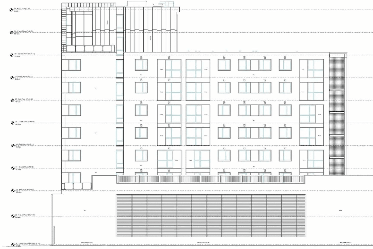
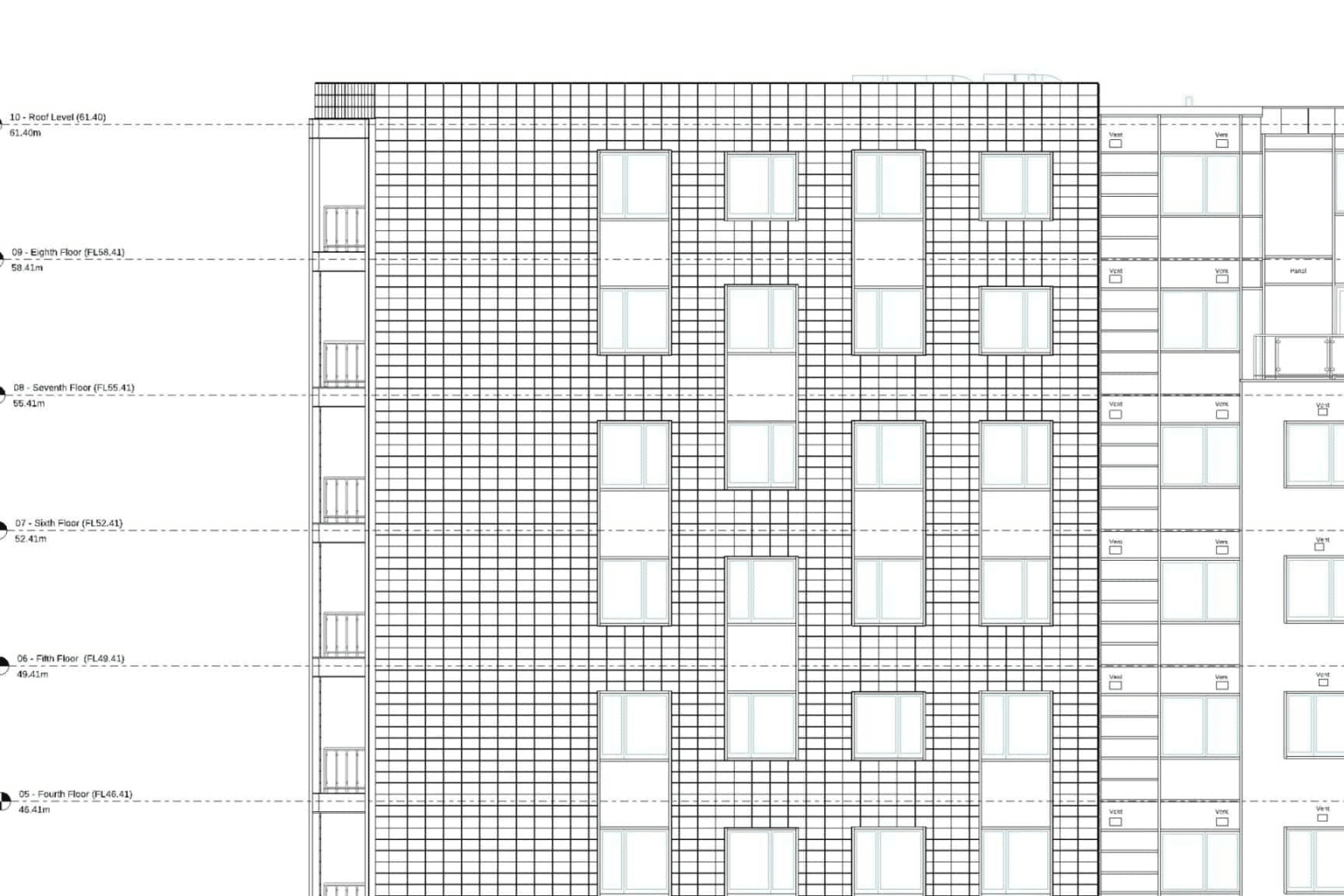
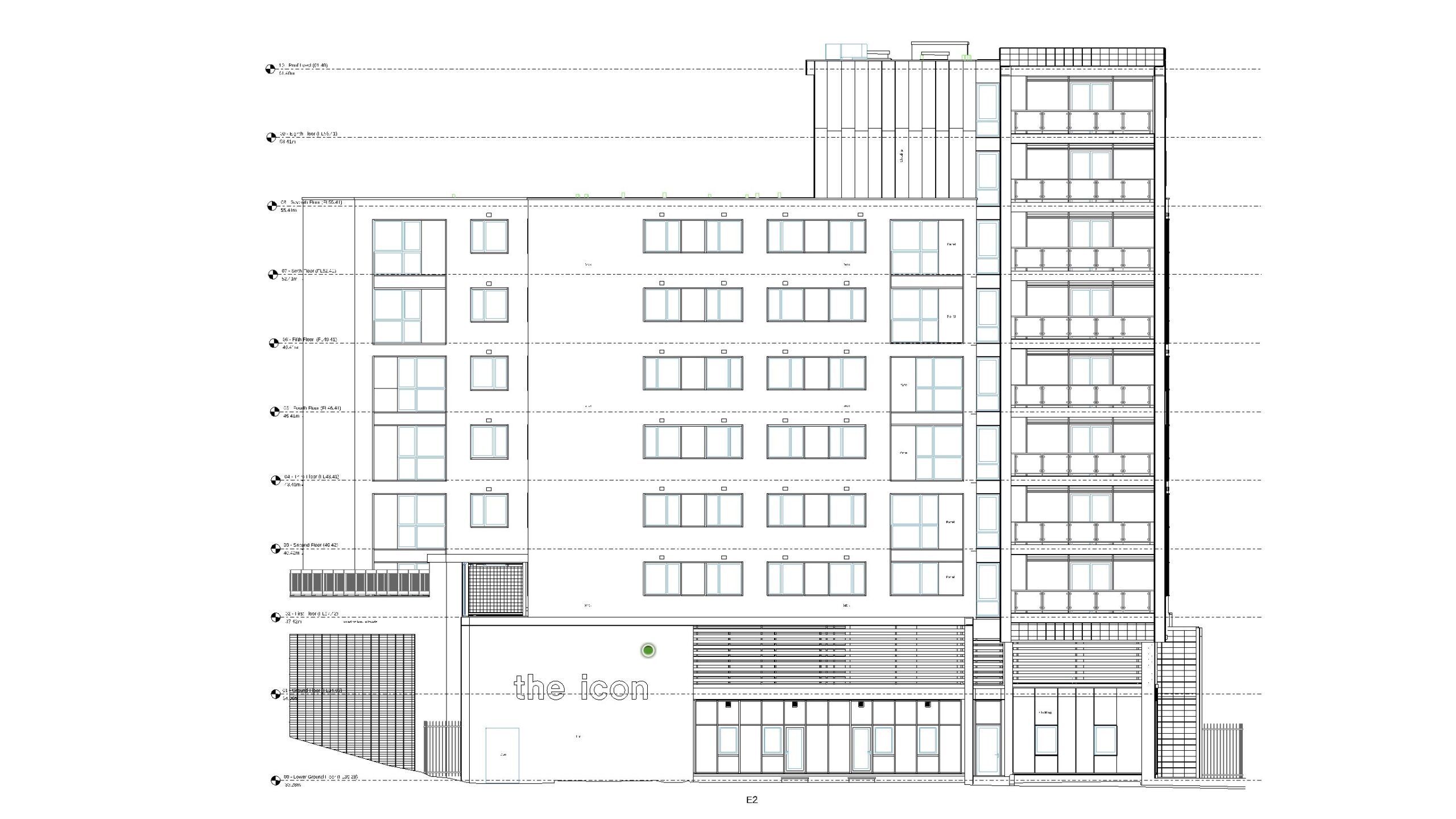
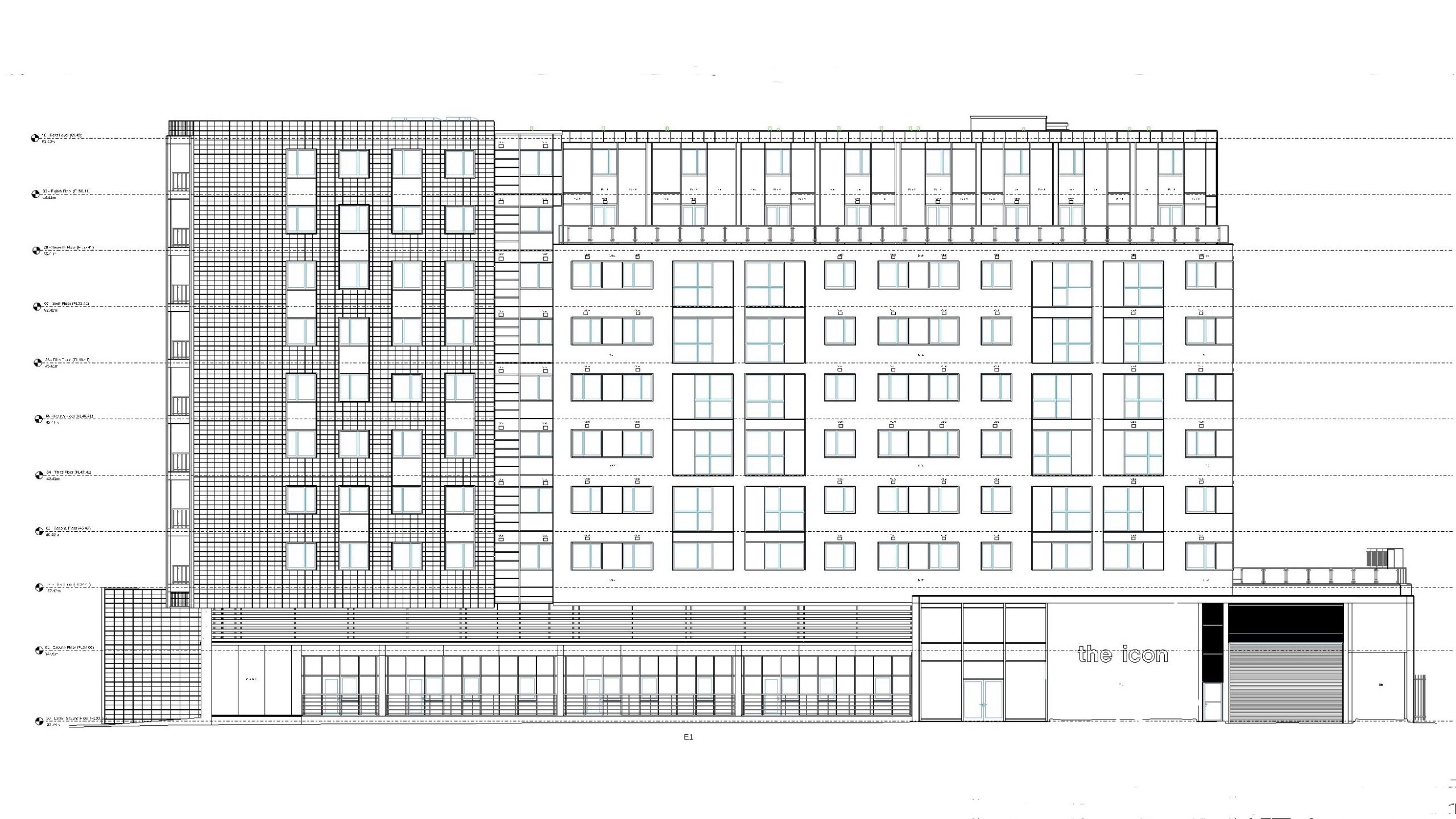
Measured Building Surveys in 2D
Measured Building Surveys delivered as high-detail 2D CAD drawings in a variety of formats suitable for all widely used CAD and design software.
Measured Building Surveys in 3D
Measured Building Surveys delivered in Revit and other formats compatible with BIM software as 3D models.
project spotlight
In March 2024, we performed a measured survey of Birmingham Botanical Gardens to facilitate planning for the upcoming transformation project. Our expert team provided a Measured Building Survey, Topographical Survey, Matterport Tour, and CCTV Drainage Survey, among other services.
What our clients say
Measured Building Survey FAQs
A measured building survey is a digital depiction of your building that shows its precise measurements and dimensions. Involving a total laser scan followed by the production of detailed digital drawings, measured surveys can show all elements of a building, including floor plans, elevations, and sections. Usually, the survey is specified to a particular level of detail, with acceptable tolerances for scale, accuracy, costs, and delivery times.
Typically, a measured survey includes elements like floor plans, elevations, and sections.
- Floor plans show the layout of each level of the building, featuring details like windows, doors, stairs, and the positions and sizes of walls.
- We term elevations as the external and internal views of a building, including their facades, materials, and heights.
- Sections constitute cross-sections of the building that reveal the structure's profile, showing information about floor and ceiling heights as well as structural elements like beams and columns.
- For heritage surveys, capturing ornamental details like mouldings and carvings is also important, as this enables conservationists to understand and respect the building's historical character.
First, the measured building surveyor travels to the site and uses specialist equipment to gather all the important information about the building. Once the data has been collected and returned to the office, skilled technicians set to work producing a detailed digitisation of the structure in question, outputting their product to the specifications of the client.
Laser scanners, total stations, and drones are the mainstays of a surveyor's toolkit. Each of these instruments uses specific technology to help the measured building surveyor capture even the finest details about a building. A total station optimises angle measurements, perfect for recording precise coordinates. Laser scanners use Light Detection and Ranging technology (LiDAR) to record precise distances between elements. Lastly, a drone employs photogrammetry to obtain data on remote elements of a building. The most advanced models of survey equipment combine these technologies to acquire the most accurate data possible.
At Bury Associates, we stay updated with the latest innovations in surveying equipment and technology, so that we can continue to deliver the most accurate and detailed surveys for our clients.
Once all the measurements have been taken, skilled technicians begin processing the raw data, which is then transformed into detailed drawings using CAD software. We also create a 3D model in a BIM-friendly format like Revit and IFC.
The measured building survey is then delivered to the client, who may request revisions or additional details, with the surveyor providing updates accordingly.
There are a variety of situations where measured surveys are required.
- Firstly, renovation and refurbishment projects must be planned in consideration of the existing structure. Not only does this ensure that the new elements fit properly, but that the design aligns with the building's structural limits. When planning on extending a building, a measured building survey should be conducted to ensure that the proposed design respects boundary limits and building regulations.
- For heritage buildings, measured surveys are essential to document the current state of the structure in great detail. This is to help restoration projects maintain historical accuracy. What is more, older structures particularly benefit from the non-invasive techniques used in a heritage survey. This is because the modern use of lasers eliminates the chance of accidental damage to the structure.
- Measured building surveys are also vital for interior design purposes. For a design to work well within the space, careful consideration must be taken of the property's internal dimensions, such as the positions and sizes of doors.
Many professionals involved at various stages of the construction process require our services. At Bury Associates, our measured building surveys have helped architects, engineers, and conservationists bring designs to life since 1997.
It is wise to commission a measured survey if you are planning on redeveloping or extending a property. Acquiring a set of accurate measurements helps to keep costs down by avoiding unforeseen complications, such as unwittingly ordering the wrong size materials, only to realise when they are due to be fitted.
A seamless construction project can be planned only with a strong foundation of prior knowledge about the building. That way, developers can conduct risk assessments, identify potential issues, and streamline the process as much as possible.
A measured building survey's duration depends on several factors, including:
- the site location
- the size and complexity of the building
- the level of detail specified by the client
- the deliverables requested
Obtaining a free quote will give you the best idea of survey timings. We will inform you of the lead time, which is the length of time before a surveyor can visit the site. At Bury Associates, we understand that deadlines can be tight, which is why we remain in constant communication with our clients. Due to our commitment to top-quality service, we can issue certain data and deliverables early if our client needs them sooner.
On average, a measured survey costs around £500 + VAT per man-day that a project takes. For example, conducting a survey of a small commercial property may involve one day on-site, followed by three days for data-processing and drawing or modelling. This would bring the cost to around £2,000.
The deliverables specified can also affect the cost of a measured building survey. Generally, prices for 2D and 3D surveys are very similar for building of a standard construction. However, heritage buildings with ornate internal features or detailed facades tend to cost more when being delivered in 3D than in 2D.
Read our dedicated blog post to find out more about the cost of a measured building survey.
Since costs can vary widely based on the location and complexity of the project, we advise you to request a quote to get an accurate price.
Our Full Range of Services
Matterport Tours
Providing you with a 3D walkthrough tour of your site
Topographical Surveys
Highly detailed land surveys showing all features, levels, & contours
Drone Inspections
Providing you with aerial inspections & surveys for inaccessible areas
Underground Utilities
Using radio detection equipment & GPR to scan underground services
Setting Out
Setting out boundaries, structures, & steelwork, & monitoring movement
Reality Capture
Photo-Realistic 3D model showing every detail for heritage projects
experts in bim
We contributed to Historic England's 'BIM for Heritage: Developing a Historic Building Information Model', drawing on our years of experience providing heritage surveys for architectural conservation projects.

Measured Survey Case Studies

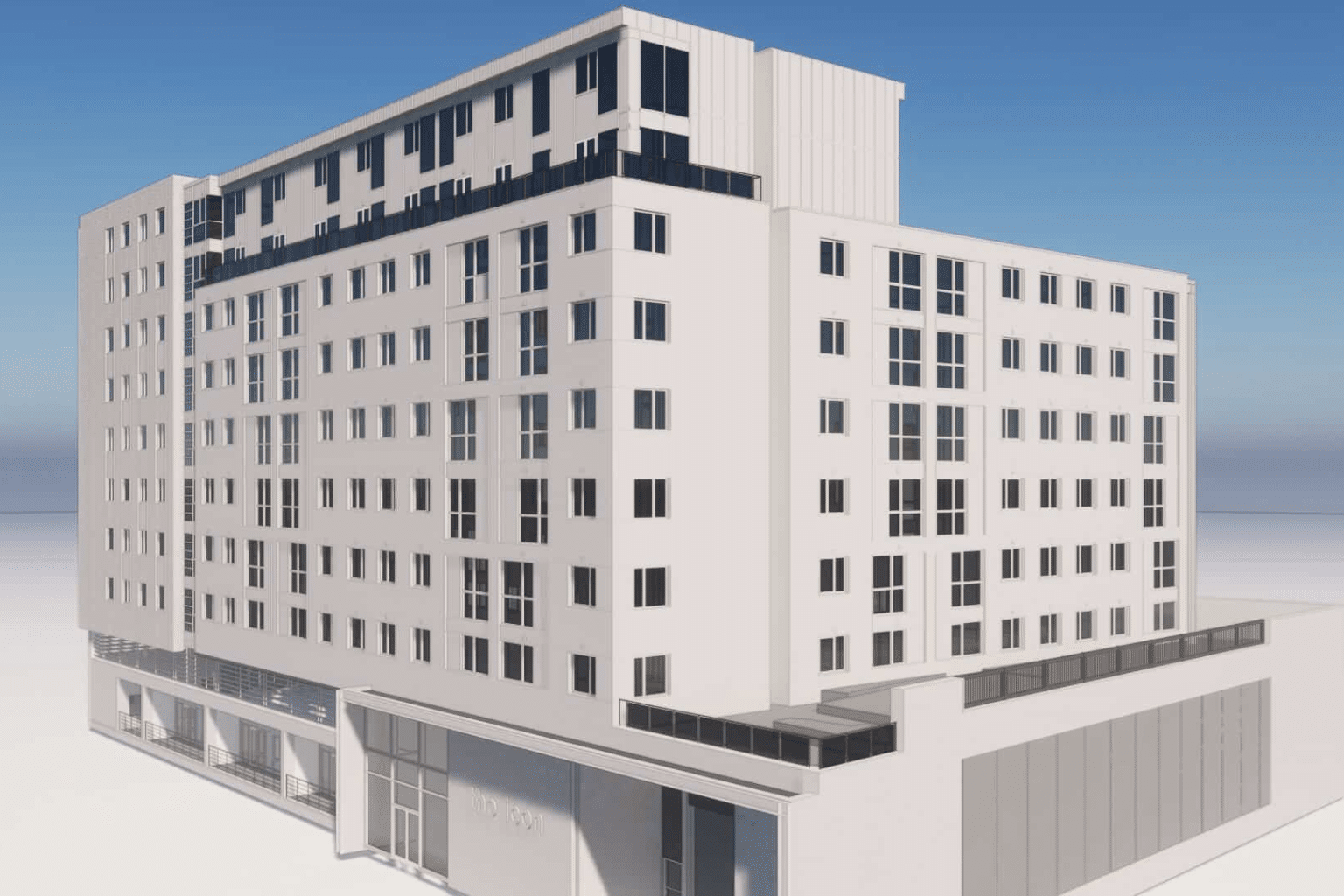
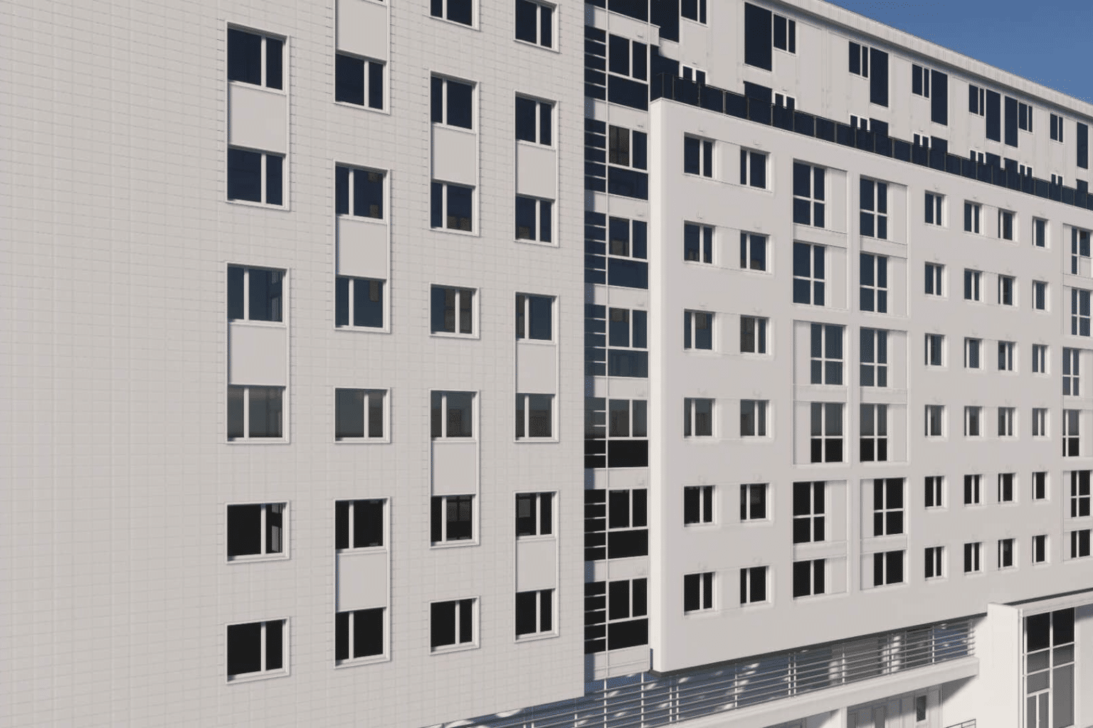
Project: Scala Theatre, Worcestershire
Bury Associates were commissioned to carry out a Measured Building Survey of Scala Theatre, Worcester. In order to capture every detail, a combination of laser scanners and drones were used to enable the creation of a high detailed 3D Revit model of this former theatre and of the surrounding city centre.
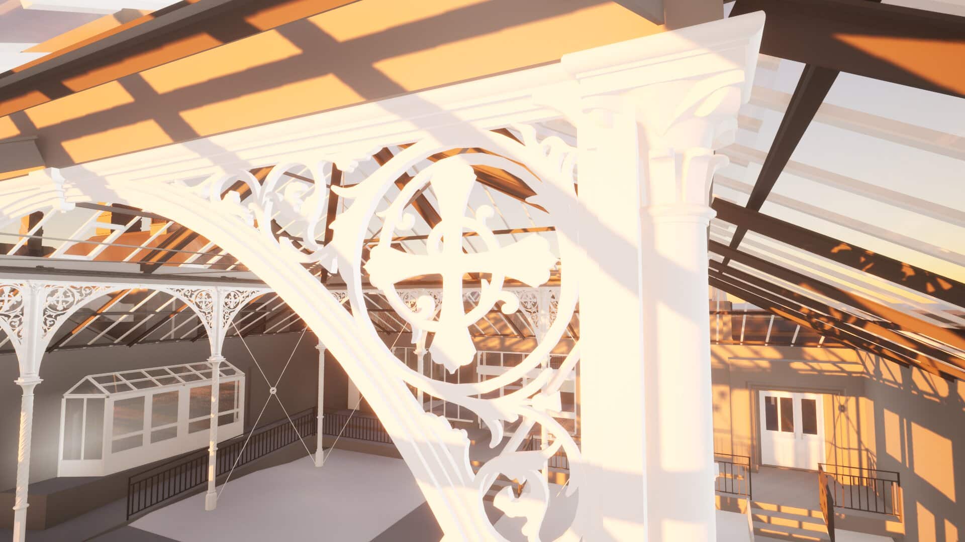
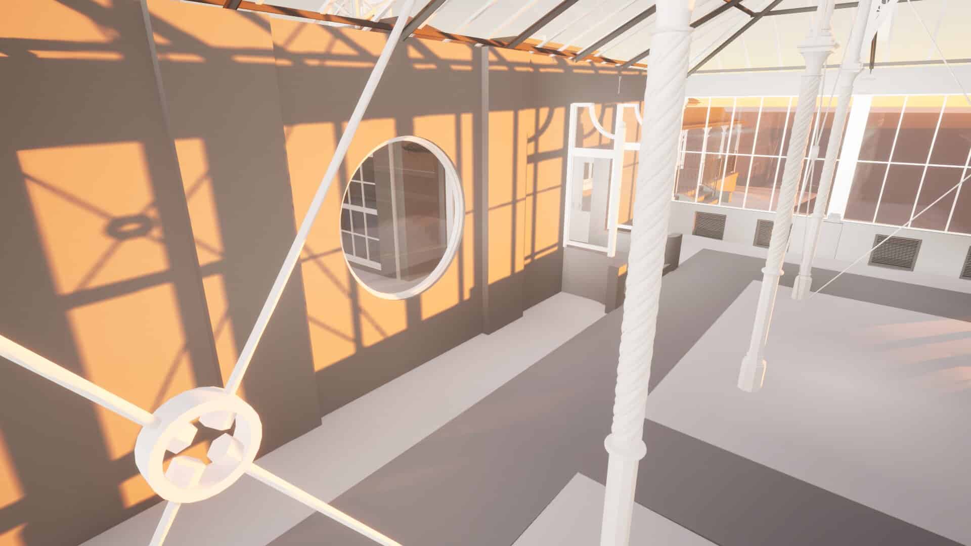
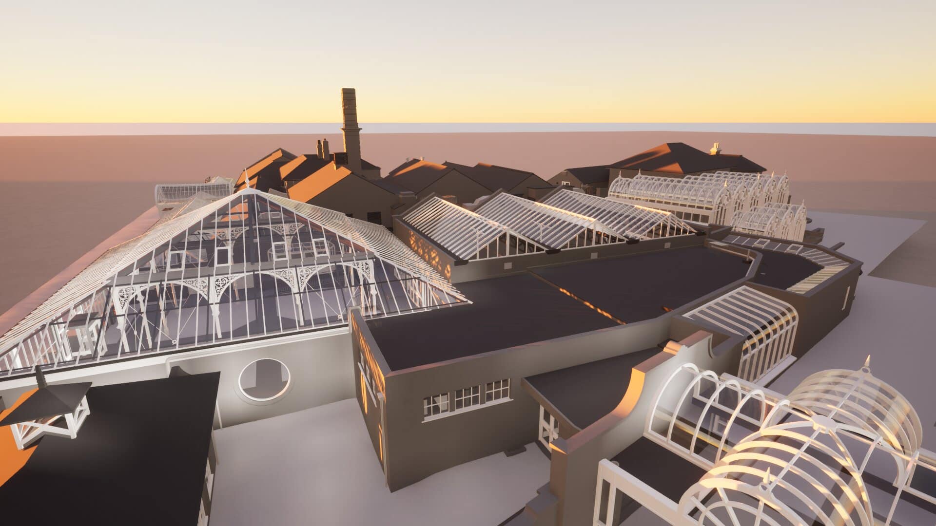
Project: Blackpool Winter Gardens
Bury Associates were commissioned to carry out a laser scanned measured survey of Blackpool Winter Gardens to assist in the repair and conservation of the complex. Data collected was used to produce highly detailed CAD drawings.


Project: Grade II Listed Farmhouse
Bury Associates were tasked with conducting a detailed measured building survey and topographical survey of this Grade II Listed Farmhouse in the southeast of England.