Measured Building Surveys: 2D vs 3D
In this article, I discuss how two-dimensional (2D) and three-dimensional (3D) measured building surveys differ. By the end, you should have an understanding of how to choose the best format for the needs of your project.

What is a Measured Building Survey?
Put simply, a measured building survey is the process by which we collect comprehensive data about a building. Surveyors document information like elevations, floor plans, and sections. Once captured, the data is configured to create a digital replica of the structure. This way, we can understand crucial information about a building before undertaking construction work. Architects use measured surveys to understand a building's existing state when conceptualising alterations. Likewise, engineers refer to the data in their considerations of a project's structural viability.
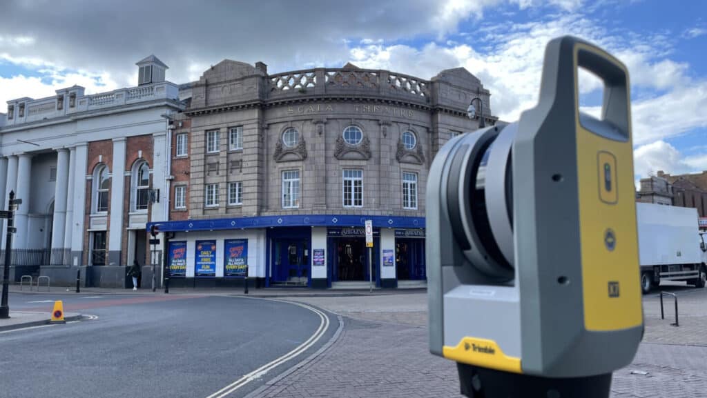
Onsite, surveyors use specialist equipment such as drones and laser scanners to take a full measurement of all the building's features. By utilising precise GPS systems, they can relate the data to Ordnance Survey co-ordinates, recording the most accurate and relevant results. Back in the office, experienced technicians get to work creating a visual, easy-to-interpret representation of the structure.
2D Measured Building Surveys
Drawn using computer-aided design (CAD) software, 2D surveys can represent key structural elements like floor plans, elevations, and sections. There are a number of advantages to this format. Firstly, 2D surveys can display various different measurements, such as square footage, floor plans, and the overall layout of a building. This focus on linear measurements makes for fast data collection, which is better suited to those who require a speedy turnaround for their survey. The resulting 2D drawings are easy to interpret, ideal for clear communication between stakeholders. Not to mention, measured surveys are generally less expensive when displayed in 2D, which is a positive for smaller projects or those with limited budgets. For a detailed look at costs, please visit our blog post on what affects the price of a measured survey.
Last week, I discussed the importance of an elevation survey to a re-cladding project, using a recent example from Bury Associates' extensive portfolio. In this instance, we represented The Icon residential building in 2D CAD, while also creating a 3D model to provide the utmost detail.
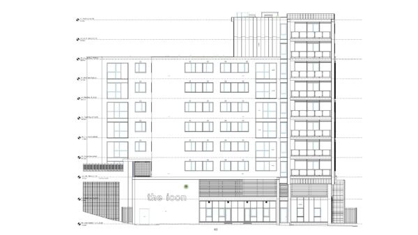
Front view of The Icon, Basildon, in 2D CAD
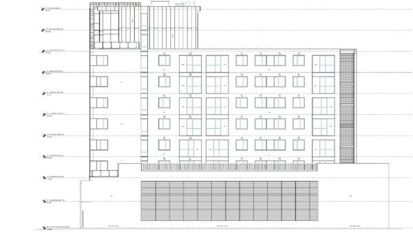
Rear view of The Icon, Basildon, in 2D CAD
3D Measured Building Surveys
Capturing heights and depths in addition to lengths and widths, 3D measured building surveys provide a complete insight into a building's structure. The collected data is registered into a point cloud, which is used to produce a 3D visualisation in an output that suits the needs of the project, such as Revit or CAD.
Due to their enhanced detail, 3D surveys employ advanced technologies like Light Detection and Ranging technology (LiDAR) and photogrammetry. For a deep dive into this topic, visit our post on survey equipment and technology.
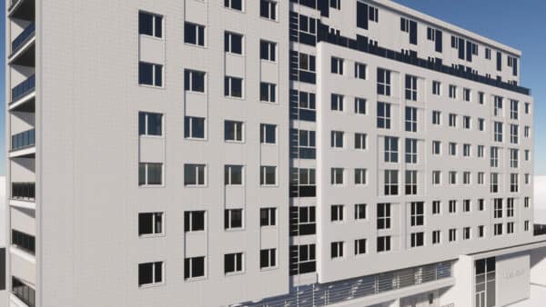
The advantages of 3D surveys lie primarily in their supreme accuracy, particularly in regards to complex architectural elements, curved surfaces, and irregular shapes. Despite the comprehensive insight they provide, 3D laser technology captures an enormity of data extremely quickly. This is particularly helpful for large structures like residential blocks or intricate heritage buildings due to the reduction in time on-site normally required for such complex projects. The biggest appeal of 3D building models in Revit is their ability to provide an immersive visual experience of the building, which gives engineers, architects, and designers the deepest possible insight into its design and structure.
The Icon residential building in Revit
Elevation of The Icon in Revit
Case Study: Blackpool Winter Gardens
In 2015, Bury Associates were commissioned to carry out a measured building survey of Blackpool Winter Gardens. A major entertainment venue, the complex was due to be repaired and conserved in a project funded by the National Lottery Heritage Fund.
Using our expertise in laser scanning, we recorded detailed information about the building's structure, including its intricate design and ornate features. The resulting data allowed the project team to make informed decisions, ensuring the preservation of this iconic heritage site for future generations.
The deliverables issued for this project included:
- 2D CAD drawings consisting of approximately 60,000 sq. m of highly detailed floor plans, reflected ceiling plans, and 2 kilometres of elevations and sections
- Point cloud data
- Orthoimages
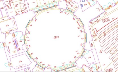
2D CAD drawing of Blackpool Winter Garden
Case Study: Former Edinburgh Royal Infirmary
Formerly Edinburgh's main hospital, the Royal Infirmary was purchased by The University of Edinburgh for use by a new faculty. In 2016, Bury Associates were tasked with carrying out a laser scan of the structure, which was then made up to a 3D Revit model.
As part of the survey, our surveyors mapped out every stone along the building’s 5 storey, 1.2km long facade to identify where repairs would be necessary. Due to the large number of these stones, we issued CAD drawings enhanced with Ortho-Images to display imperfections in the stonework.

Revit model of former Edinburgh Royal Infirmary created from laser-scanned point cloud
Conclusion
When making the choice between 2D and 3D measured surveys, you should first consider the specific requirements of your project. If you need a quick, cost-effective survey of a building, 2D CAD drawings can provide you with accurate data at an affordable price.
3D surveys, with their superior accuracy and comprehensive data, are a better choice for those undertaking complex architectural, engineering, and design tasks.
At Bury Associates, we provide every type of survey. Since our establishment in 1997, we have led the surveying industry in adopting ever more innovative technology. Get in touch for your quote today.
Ready to find out more?
Tell us about your project today.


Steve Bury is the Managing Director of Bury Associates, a land and measured building survey company based in the UK. With over 40 years of experience in surveying, Steve Bury established Bury Associates in 1997 to combine the provision of high quality digital surveys with exceptional customer service. Steve has also designed software applications for measuring buildings to automatically create survey drawings.