Barn Conversions: How To Upgrade Your Measured Survey
In this article, I explain why you need more than a simple measured survey when carrying out barn conversions in sensitive locations.
Need a Measured Survey?
The Complexity of Planning Permissions in Sensitive Areas
Obtaining planning permission for projects within National Parks or Areas of Outstanding Natural Beauty (AONBs) is always a challenge. While the government recently proposed to offer more flexibility in converting agricultural buildings into residential spaces, park authorities stand in opposition to this suggestion.
Commissioning land and measured survey services gives a planning application a better chance of approval. By identifying potential issues early in the planning process, measured building surveys allow project teams to address concerns. For example, a measured building survey can help ensure that heritage features are properly preserved and integrated into the proposed development.
Why a Simple Measured Building Survey Is Not Always Enough
Although traditional CAD-based measured building surveys serve as a useful baseline, they are insufficient for sensitive structures like historic barns, many of which have listed status. Simple CAD drawings often lack the detailed information needed for planning permission in protected areas, especially when compared with more advanced surveys that feature immersive photographic tours and 3D inspection models.
Advanced Techniques for Reality Capture
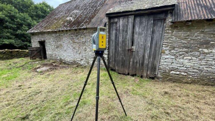
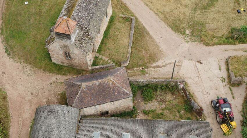
Utilising modern reality capture techniques enables a more in-depth understanding of a barn's structure and condition, accessible directly from your computer screen. Reality capture includes 3D models created via laser scanning and photogrammetry, which offer the supreme level of detail necessary for detailed building inspections. Enhancing high-quality CAD survey drawings with these reality capture models and immersive Matterport tours provides a level of information that will satisfy even the most rigorous of planning authorities.
Our Enhanced Measured Surveys for Barns Usually Comprise Three Main Elements:
- A Photo-realistic reality capture model, achieved by combining laser-scanned point clouds with drone and terrestrial photogrammetry. Such models capture the building's exterior in great detail.
- A Matterport tour created with the Pro 3 camera, which allows for a fully immersive virtual tour of the building, both inside and outside. The measurements and mark-ups can easily be shared among the team.
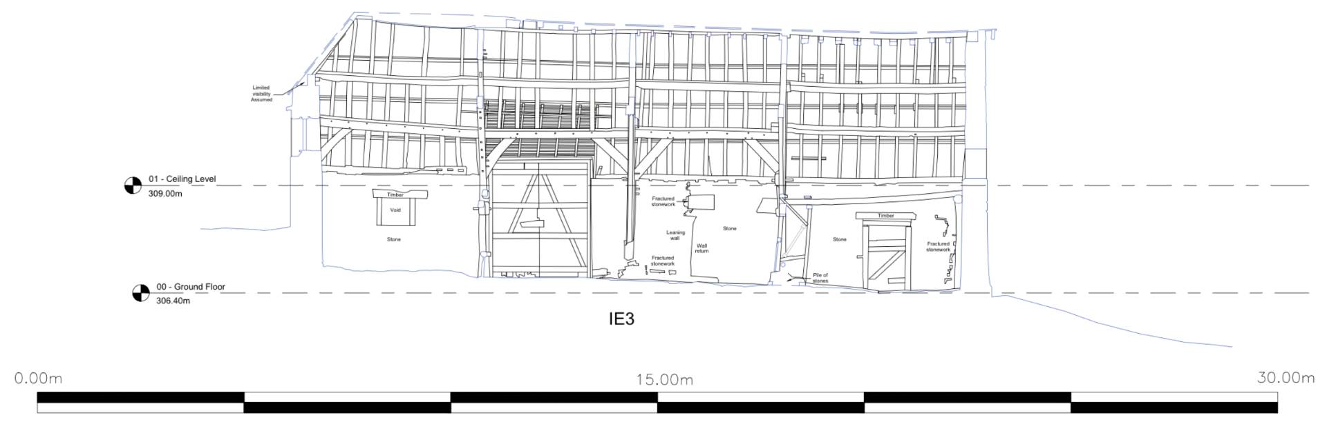
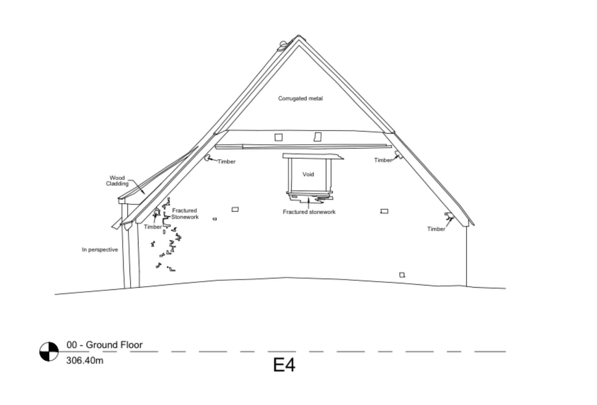
- High-detail CAD drawings, which highlight timber joints, cracks, and intricate stonework, serving as essential resources for the design work.
Often, we also include a fourth element: a 3D model in a BIM format such as Revit or IFC. While our modelling team excels at rendering complex structures, even modern design software has its limitations, particularly with organically shaped features like roughly hewn cruck frames. We recommend retaining some elements in the BIM model at a lower level of detail and referring to the reality capture models and high-detail CAD drawings for the more complex features.
The Advantages
Using our enhanced measured surveys for barn conversion projects offers several benefits. The wealth of captured data minimises the need for multiple site visits. Additionally, the survey acts as a lasting digital footprint of the building before transformation, useful for future renovations.
Conclusion
In summary, the complexities of obtaining planning permission for structures in National Parks and AONBs require a multi-faceted approach that goes beyond simple measured building surveys. Employing techniques such as photo-realistic reality capture models, immersive Matterport tours, and high-detail CAD drawings can greatly streamline the design process, cut down on-site visits, and serve as a permanent digital record. Embracing these advanced methods allows for more effective navigation of the complex planning landscape, ensuring the respectful transformation of historical structures.
Other measured survey resources
We can provide your measured survey
Steve Bury is the Managing Director of Bury Associates, a land and measured building survey company based in the UK. With over 40 years of experience in surveying, Steve Bury established Bury Associates in 1997 to combine the provision of high quality digital surveys with exceptional customer service. Steve has also designed software applications for measuring buildings to automatically create survey drawings.