Borehole Position Surveys
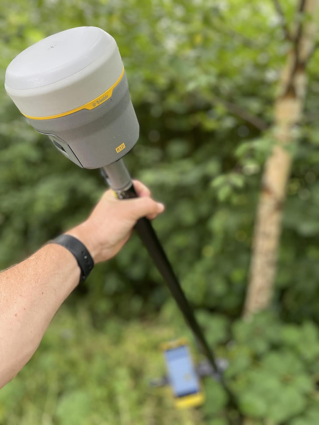
Borehole surveys are the backbone of effective site investigation. Your project depends on accurate, safe positioning of every borehole, trial pit and monitoring well. This is where our use of the Trimble R12i GNSS receiver proves valuable. It delivers reliable coordinates on busy, obstructed and uneven sites, fast.
Why borehole positioning can be tricky
On live construction sites and brownfield plots, borehole points rarely sit in ideal locations. Fences, hoarding, vegetation, plant and traffic management block a clear view of the sky. At times this hinders GPS performance. We often work right up to edges, beneath overhead obstructions or inside compounds, and the challenge of “holding the bubble” on a vertical pole limits our speed and risks losing accuracy.
How the Trimble R12i changes the game
The R12i’s IMU-driven tilt compensation lets us measure borehole points with the pole angled, without compromising precision. Practically speaking, this lets us reach up to fences, against rigs or under vegetation where a vertical pole might fail. Trimble’s signal processing helps us capture accurate coordinates in complex environments on the first visit.
- Speed: No more levelling the bubble at awkward angles - we work faster around rigs and obstacles.
- Safety: Maintain stand-off distances and minimise time in vehicle routes or exclusion zones.
- Accuracy: Consistent results for set-out and as-built checks on the same grid and datum.
- Traceability: Photos, codes and metadata recorded with every observation for a robust audit trail.
Want to know more about our positioning capability? See our overview of GPS surveys.
Our borehole survey workflow
- Brief and GI plan: We ingest your exploratory hole schedule and target coordinates, agree coordinate system and vertical datum, and clarify set-out tolerances, markings and naming conventions.
- Control and verification: We tie into existing survey control or establish new control, then verify position and level so set-out and as-built can be compared like-for-like.
- Set-out on site: Using the R12i, we mark each borehole location (paint, pin or lath), capture photos and notes, and provide immediate feedback on any clashes with utilities, access or safety constraints.
- As-built capture: After drilling, we record final positions of boreholes, trial pits and monitoring wells, including cover levels, cap type and any offsets from design if relocation was required.
- Quality control and delivery: Later, we run checks, flag variances, and deliver clean data - typically CSV, DWG/DXF and a plotted plan with coordinates, levels and codes - ready for your GI report or BIM model.
Integrating with wider site survey needs
Borehole surveys rarely stand alone. Accordingly, our team can combine ground investigation set-out with a topographical survey to provide context, levels and access planning. Where underground risk needs managing, we can schedule underground utility surveys ahead of drilling to reduce strike risk and inform rig positioning. Following this, for active or sensitive sites, we offer monitoring surveys to check for movement. If you’re interested in the tools we bring to site, here’s our guide to topographical survey equipment.
What this means for your project
In practical terms, using the R12i for borehole surveys means fewer site revisits, tighter control on as-built accuracy and a clear, defensible record for your investigation report. Designers get dependable coordinates and levels; contractors get faster set-out and safer working; and project managers gain schedule certainty with fewer surprises.
Planning a borehole campaign?
If you’re at concept stage, we can help shape a survey scope that aligns with your ground investigation strategy, your risk register and the realities of site access. If you’re ready to proceed, send us your GI plan and we’ll propose an efficient programme that integrates set-out, utility clearance and topographical capture where needed. Alternatively, you can request a survey quote and we’ll get straight back to you.
Accurate positioning underpins confident ground decisions. With the Trimble R12i’s tilting technology and our established QA process, every borehole, pit and well can be mapped precisely - no matter how awkward the location.
Steve Bury is the Managing Director of Bury Associates, a land and measured building survey company based in the UK. With over 40 years of experience in surveying, Steve Bury established Bury Associates in 1997 to combine the provision of high quality digital surveys with exceptional customer service. Steve has also designed software applications for measuring buildings to automatically create survey drawings.