Our Blog

I want to sell part of my land to a neighbour. How do I get new plans drawn up to submit to Land Registry?
I want to sell part of my land to a neighbour. How do I get new plans drawn up to submit to Land Registry? With the right plan and a clear process, this can be straightforward. Below is a practical guide to creating a Land Registry-compliant plan (often called a “deed plan”) and getting the…

What drawings do we need for a church reordering project?
Church reordering projects are exciting, complex and highly scrutinised. Whether you’re removing pews, improving accessibility, introducing a servery or weaving new services through an ancient fabric, success rests on one thing: robust, accurate drawings. Here’s a clear guide to the drawings you’ll need, why they matter, and how a measured building survey using laser scanning…
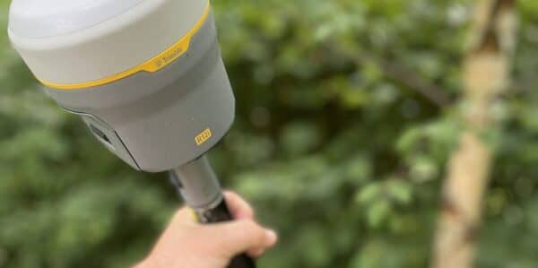
Borehole Position Surveys
Borehole surveys are the backbone of effective site investigation. Your project depends on accurate, safe positioning of every borehole, trial pit and monitoring well. This is where our use of the Trimble R12i GNSS receiver proves valuable. It delivers reliable coordinates on busy, obstructed and uneven sites, fast. Why borehole positioning can be tricky On…

Scaffolding & Surveys: How to Avoid Delays, Cut Costs, and Get It Right First Time
You’ve got a building to develop, restore or redesign – and you need accurate elevation surveys. But there’s a problem: scaffolding is already up. Netting and sheeting are in place. Time is tight. You’re wondering: “Can we still get this surveyed?” Yes, usually. But it may take longer, cost more, and miss critical details…
How AI Helps Architects See Buildings More Clearly
At Bury Associates, we are committed to providing cutting-edge tools and services that help our customers to envision, design, and deliver projects with confidence. Recently our integration of Matterport’s new Defurnishing AI feature into our services has caused quite a stir! This groundbreaking technology allows architects to instantly visualise any building as if it were…

EV Charging Point Surveys
How Bury Associates can help you with your EV Charging Point installation using Laser Scanning and Underground Utilities Surveys.
Heritage Surveys for Adaptive Reuse
Find out why heritage surveys play an important role in adaptive reuse – redesigning historic buildings for new, creative purposes.
How to Add Heights to Hundreds of Trees At Once In n4ce Using Point Clouds
To level up your topographical surveys, we’re showing you how to add heights to hundreds of trees at once using laser point clouds in n4ce.
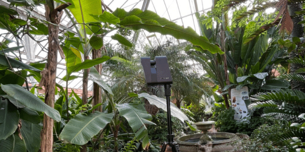
How Do We Survey Botanical Gardens?
Expounding the transformation project planned for Birmingham Botanical Gardens and the role we have played in ensuring its success.